

This site is photo and video focused combination of hikes, bike rides and other outdoor sports with the occasional visit to a small brewery or winery.
We are also working on offering outdoor sports guiding and coaching.
Biking Utah Colorado Alaska Mountain Eagle Hike MTB Trail Travel Train Creek Glacier
![]()
![]()
![]()
![]()
![]()
![]()
![]()
![]()
![]()
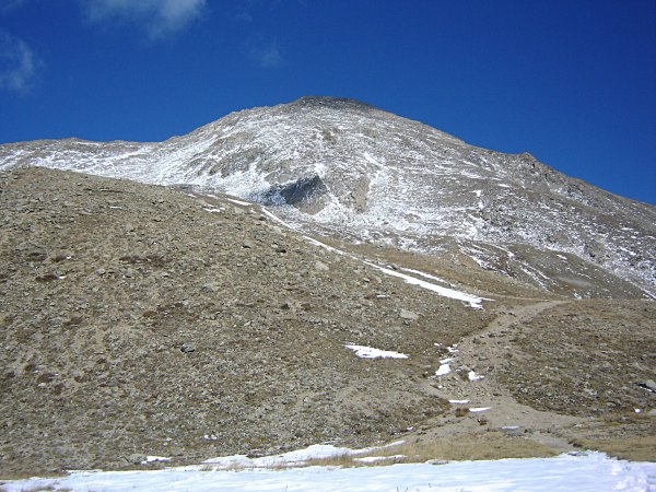
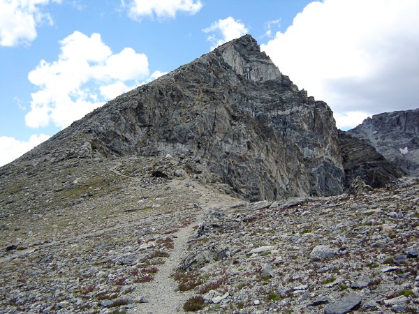
Mt. Yale
I haven't posted any 14er hikes this year, so here's one. Three of us hiked up Mt. Yale, about 10 miles west of Buena Vista, Colorado, in early-mid October. It is one of the collegiate peaks in the Sawatch Range. At 14,196 it is the 21st highest mountain in Colorado. Colorado did not get much rain this summer, but in October the skies started to...
Full Post
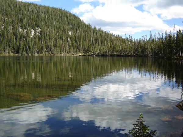
Crater Lake #2 North
This hike was to the same location as the last one in my last blog. The difference was, there was no snow, so we stayed on the trail and after the middle lakes we went up and did not visit the first one. We started on South Boulder Creek Trail and turned onto Crater Lakes Trail. There is a sign at the junction. The trail to Crater Lakes was a bi...
Full Post
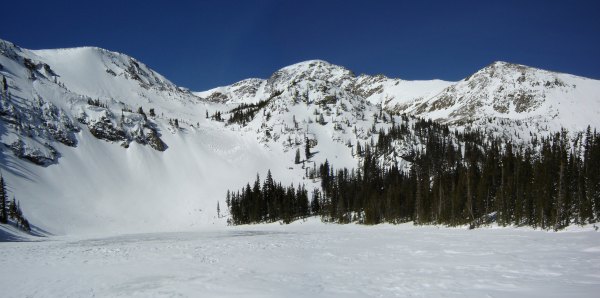
Crater Lake #2 South
Crater Lakes Snowshoeing (March 2007) November 14th 2010 10:49PMThe Crater Lakes are in the James Peak Wilderness, southwest of Boulder. The closest trailhead is at the East Portal of Moffat Tunnel (usually called just East Portal). This area usually has a good snowpack in the winter. The main trail through this area, Sout...
Full Post
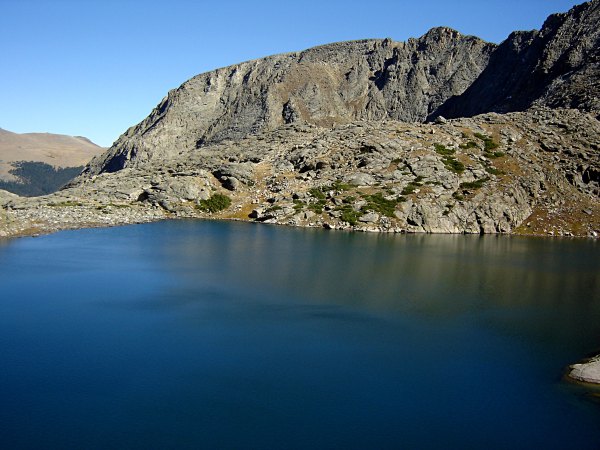
Arrowhead Lake (or is it Right Turn Arrow Lake)<br>Love Lake is just to the right and above the point of the arrow.
After Inkwell Lake there was some more above treeline rock scrambling. Two of us headed over towards Doughnut Lake, which is in a separate drainage from the other until below Arrowhead Lake. We found a great spot which overlooked both Doughnut Lake and Arrowhead Lake. We could also see Love Lake, which is about 200 feet above Arrowhead.
[...
Inkwell Lake
Rocky Mountain National Park has a road called the Trail Ridge Road, which goes above treeline for several miles. At its Forest Canyon Overlook, you can see several lakes in a side canyon. Many people stop and stare at them, but they get few visitors, since there is no trail to them. I have seen these lakes many times and have been wanting to ge...
Full Post
South Arapaho Peak
This trail starts from the Rainbow Lakes campground, crosses into the Indian Peaks Wilderness and quickly climbs above treeline. The trail goes along the border of a restricted area where part of Boulder's water supply comes from.
The trail continues to climb until about 12,600 feet where it levels out. After abo...
Full Post
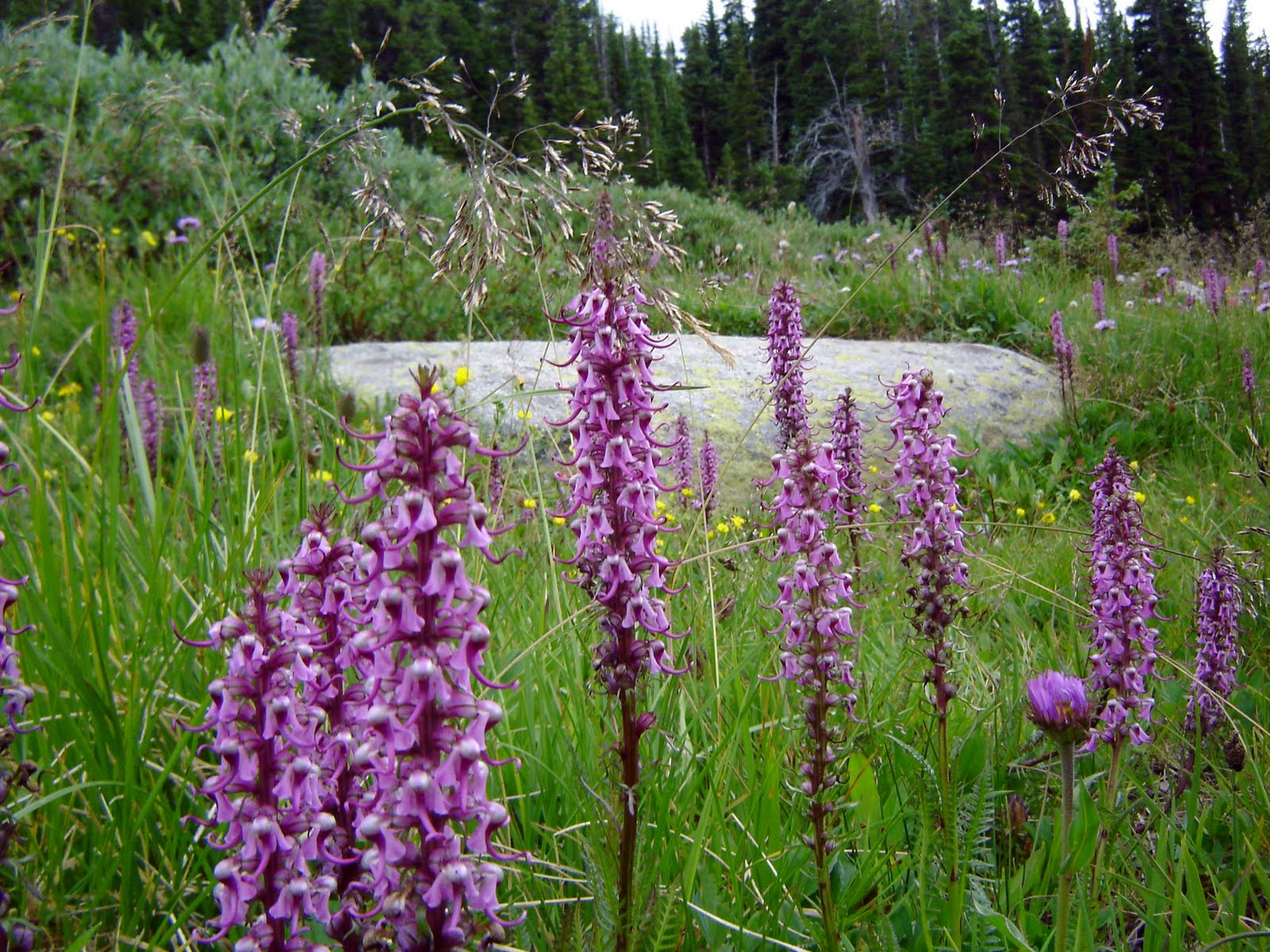
Elephant's Head
Last weekend went hiking around Long Lake in the Indian Peaks Wilderness. My main camera was having problems, so I had my old camera with me and the pics are not as sharp as usual. After about a half mile I was really wishing for my other camera. The wild flowers along the trail were great. It was an amazing display of colors.
[img_full_b...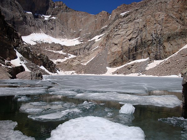
Chasm Lake sits at the base of the face of Longs Peak and is one of the most scenic lakes in the park. The lake is at 11,800 ft (just above treeline) and Longs Peak at 14,255 towers above it. We started from the Longs Peak trailhead on the east side of the park. The trail starts out climbing through a pine forest. Once it crosses the treeline th...
Full Post
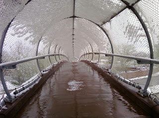
Last Tuesday night and Wednesday morning we got about 4 inches of snow. This time of year, the snow down here is a lot wetter than usual and sticks to things. This picture is of a bike path bridge over Foothills Parkway. The bridge is covered with a fence and this day the snow made it feel like a covered bridge.

Aspens
Last week I was lucky enough to go to Powderhorn, the day after the skies opened up and dumped 10 inches of white fluffy stuff. It was great boarding, especially in the trees where it was deep enough to be sweet powder, but not so deep that it was hard to get going after falling. Here's the view from one of the lifts.
Full Post
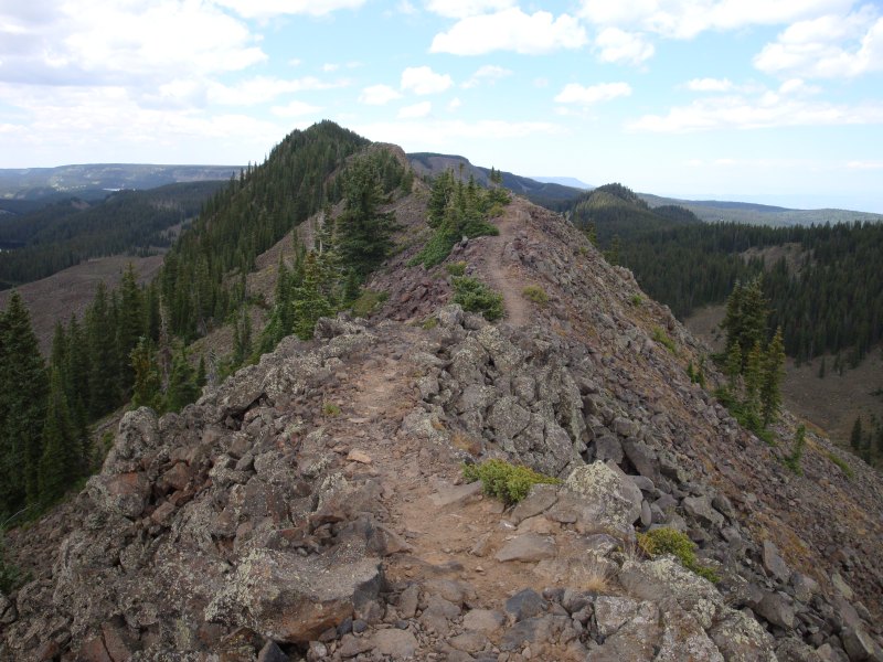
Grand Mesa Trip 8-09 - Crags Crest Trail
Crags Crest National Scenic Trail (August 2009) February 02, 2010 3:09PMIn western Colorado near Grand Junction there's a big chunk of land rising above the desert. Grand Mesa National Forest rises several thousand feet about the Grand Valley and is covered with pine forests, alpine lakes and trails. The forest has the Cra...
Full Post
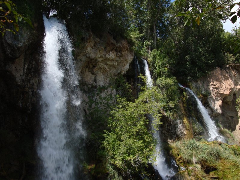
Grand Mesa Trip 8-09 - Rifle Falls
On my way out to Grand Junction last August I stopped by Rifle Falls State Park. About a 20 minute drive from the interstate. It is a small park with a few trails, a campground and of course a triple waterfall.
The trails go to the base of the falls, across the top of them and even behind one of them.
...
Full Post
©2022 - 2026 Mountain Adventures LLC all rights reserved (Designed by On the Grid Web Design LLC)