

This site is photo and video focused combination of hikes, bike rides and other outdoor sports with the occasional visit to a small brewery or winery.
We are also working on offering outdoor sports guiding and coaching.
Biking Utah Colorado Alaska Mountain Eagle Hike MTB Trail Travel Train Creek Glacier
![]()
![]()
![]()
![]()
![]()
![]()
![]()
![]()
![]()

Naturita Ridge
Desert riding going up to a ridge between two valleys in Colorado. This is actually a route of several doubletrack trails and roads, even though it shows as a single trail on Trailforks, that are also open to atvs and dirt bikes. There wasn't any real hard technical sections, but a fun scenic exercise loop with some rockiness.
Trail Li...
Full Post
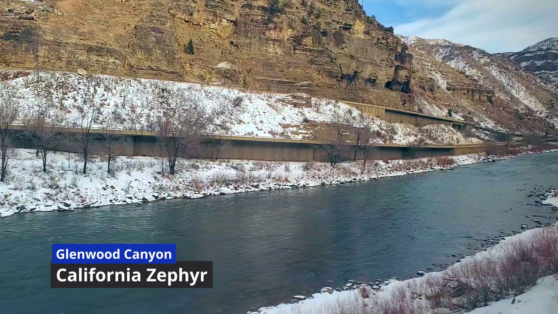
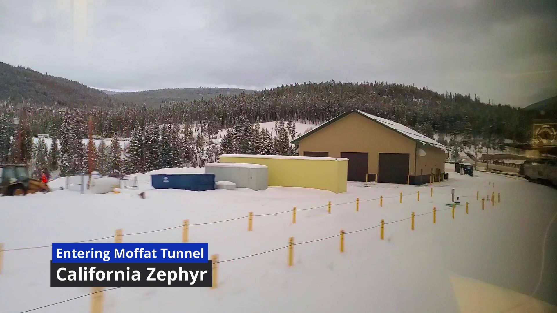
View from an eastbound Amtrak California Zephyr going into the Moffat Tunnel in Colorado. This video was taken from a roomette (you can see a temperature control in the window reflection).
Sound: Actual sound
View from an eastbound Amtrak California Zephyr going into the Moffat Tunnel in Colorado. This video was taken from a roomette (you can see a temperature control in the window reflection).
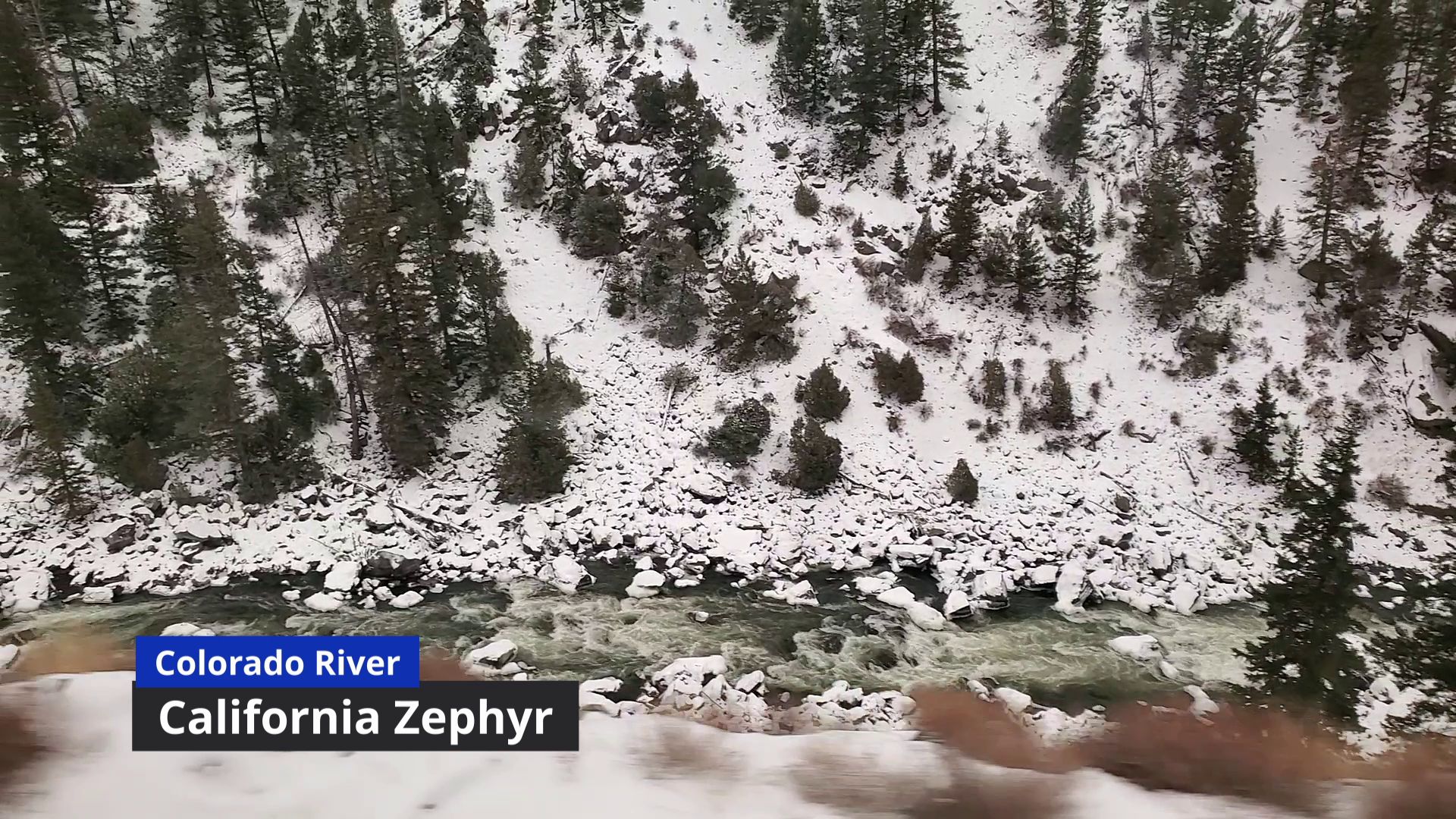
Views of the Colorado River in Gore and Byers Canyons from an eastbound Amtrak California Zephyr. Sorry about the haze and spots, Amtrak needs to clean their windows.
Music: Adventures in Adventureland by Kevin MacLeod (incompetech.com)
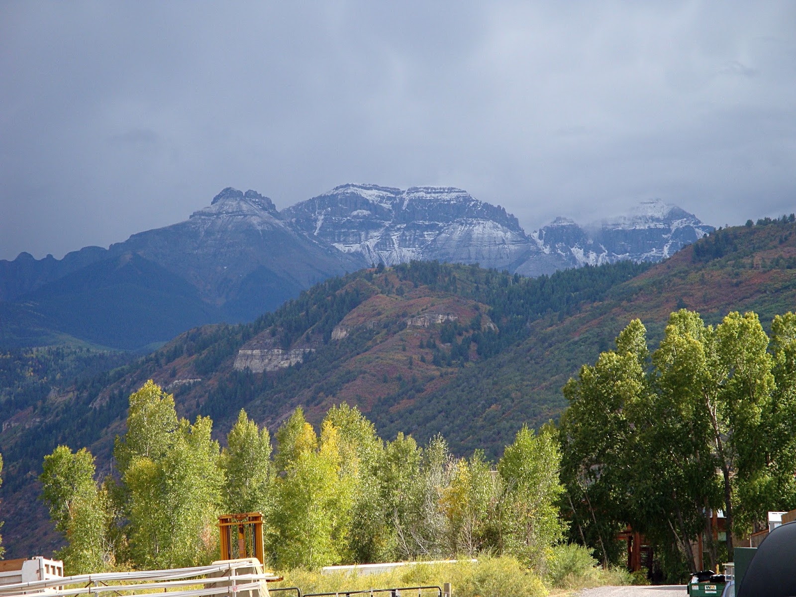
Ridgeway Has Some Nice Views of the Nearby San Juans
This is the last of the three articles I wrote for the website Trazzler which is no longer. It's not a ride or hike, just a stop we made on a rest day between climbing 14ers. Photos are from a trip in 2009For most, the town of Ridgeway is where your turn to go to Telluride or go straight to Ouray. Just off the main road, theres the Colorado ...
Full Post
Mud Lake
This is the second of three articles I wrote for the website Trazzler which disappeared a few years ago. Photos are from a ride in 2009Head north from Nederland on the Peak-to-Peak highway and you will see a sign for Caribou Ranch Open Space. Turn there and soon see a sign for the Mud Lake Open Space. There are several miles of trails here w...
Full Post
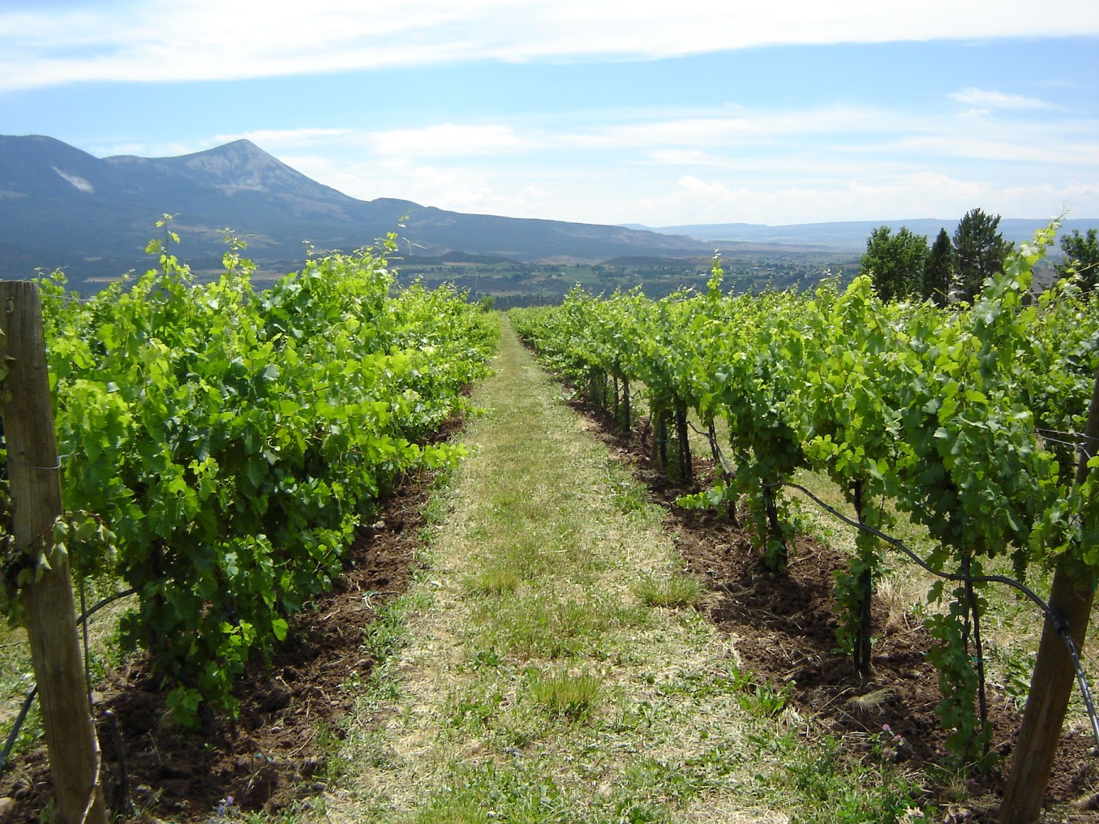
The Vineyards at Stone Cottage Cellars
This post is actually an article I wrote for the website Trazzler, which no longer exists. Photos my trip there in 2008 have been addedIn the West Elk Wine Region of Colorado there are several small wineries that they dont sell their wines outside the region.
[img_full_block 189]One of the best parts of stopping at these wineri...
Full Post
The Benjamin Trail
The Benjamin Trail is a trail I worked on last fall; one day of trail building and one day of old trail removal. It is an addition to another trail at Betasso Open Space near Boulder. It opened in May and I was able to get a chance to ride it. It was very popular and there was many other people besides the five that went with me.
The B...
Full Post
Mt. Yale
Mt. Yale, about 10 miles west of Buena Vista, Colorado is 14,196. This 9.5 mile hike was in October and snow had already fallen on the peak.
Crater Lake #2 North
This hike was to the same location as the last one in my last blog. The difference was, there was no snow, so we stayed on the trail and after the middle lakes we went up and did not visit the first one. We started on South Boulder Creek Trail and turned onto Crater Lakes Trail. There is a sign at the junction. The trail to Crater Lakes was a bi...
Full Post
Arrowhead Lake (or is it Right Turn Arrow Lake)<br>Love Lake is just to the right and above the point of the arrow.
After Inkwell Lake there was some more above treeline rock scrambling. Two of us headed over towards Doughnut Lake, which is in a separate drainage from the other until below Arrowhead Lake. We found a great spot which overlooked both Doughnut Lake and Arrowhead Lake. We could also see Love Lake, which is about 200 feet above Arrowhead.
[...
Inkwell Lake
Rocky Mountain National Park has a road called the Trail Ridge Road, which goes above treeline for several miles. At its Forest Canyon Overlook, you can see several lakes in a side canyon. Many people stop and stare at them, but they get few visitors, since there is no trail to them. I have seen these lakes many times and have been wanting to ge...
Full Post
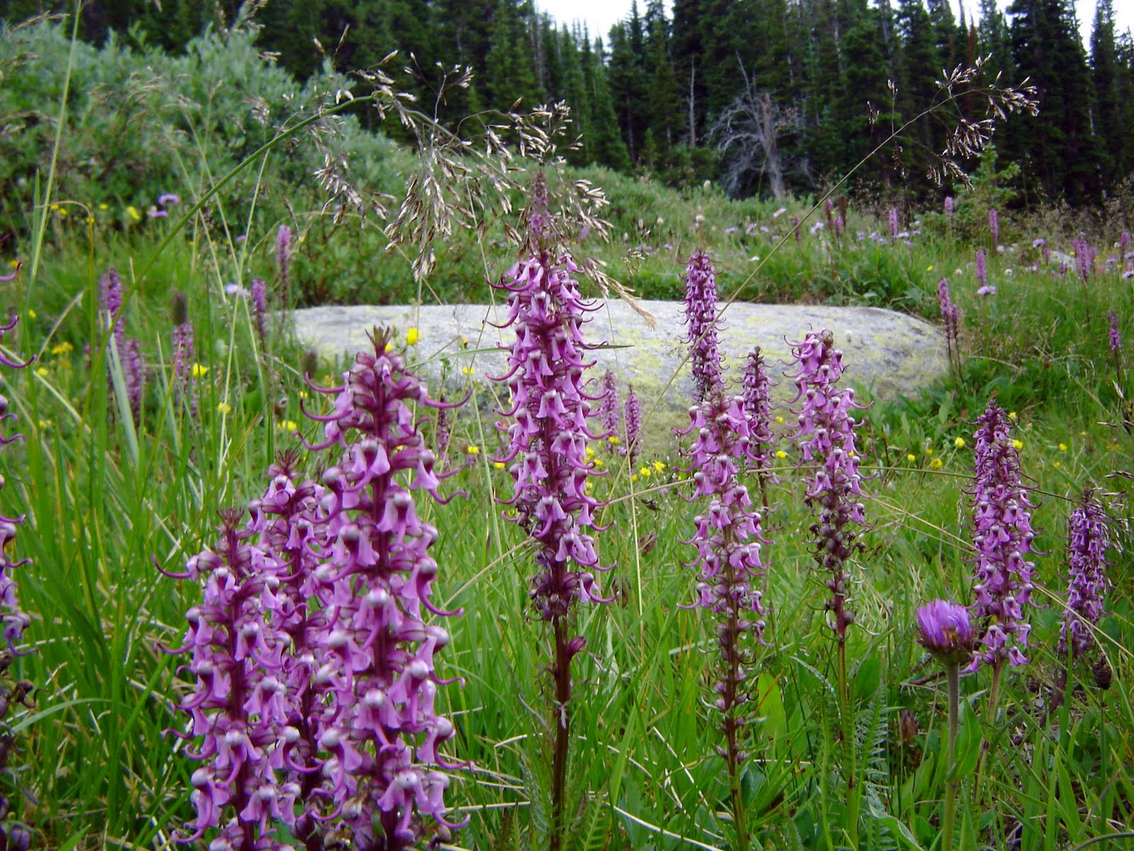
Elephant's Head
Last weekend went hiking around Long Lake in the Indian Peaks Wilderness. My main camera was having problems, so I had my old camera with me and the pics are not as sharp as usual. After about a half mile I was really wishing for my other camera. The wild flowers along the trail were great. It was an amazing display of colors.
[img_full_b...
Grand Mesa Trip 8-09 - Crags Crest Trail
Grand Mesa rises several thousand feet above the Grand Valley and is covered with pine forests and lakes. Crags Crest National Scenic Trail is a 10 mile loop on the Mesa.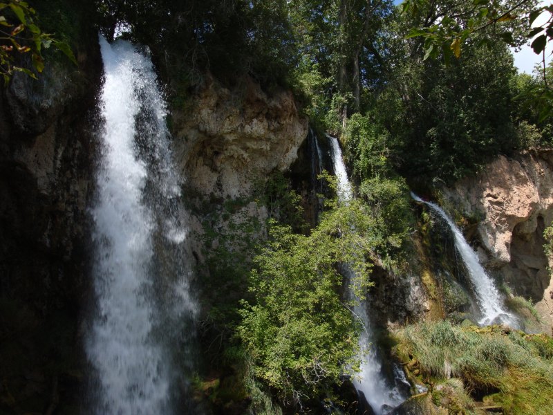
Grand Mesa Trip 8-09 - Rifle Falls
On my way out to Grand Junction last August I stopped by Rifle Falls State Park. About a 20 minute drive from the interstate. It is a small park with a few trails, a campground and of course a tr...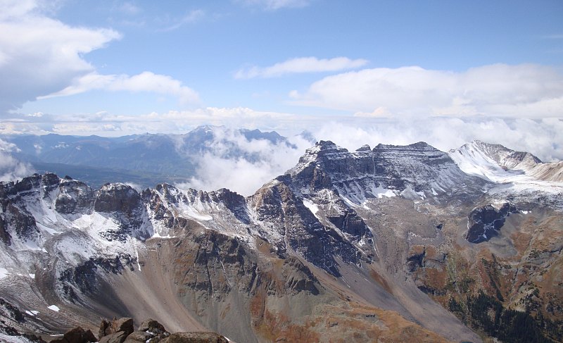
San Juans Trips 9-09 - View When the Clouds Had Cleared
(San Juans - Part 3)Mt. Sneffels is third highest mountain in the San Juans, 14,150 ft. The hike up it is short, but steep and fun. The drive from Ouray to the trailhead was very scenic and part of it is a shelf road with amazing views.
[img 61] Overhanging Rock
[img 6...
Full Post
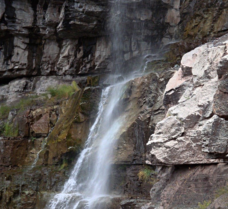
San Juans Trips 9-09 - 57 Cascade Falls
A collection of photos from Ouray and Ridgeway, Colorado including a brewery or two, mountain scenery and a waterfall.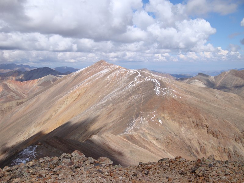
Redcloud Peak
(This is the first of several trip reports from my San Juans trip in September.)
We started at the Silver Creek Trailhead for the climb up Sunshine and Redcloud Peaks. The first part of the trail followed Silver Creek up through a scenic valley.
[img 50]Trail Going Along Silver Creek
We tur...
Full Post
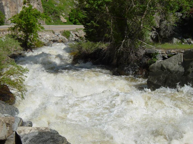
Rapids
Photos of Boulder Creek near flood stage with it going over its banks and damage a bridge. It's rapids were big with long stretches of whitewater.
The Peak Sticking Up Above a Ridge
The Mountain of the Holy Cross, with an elevation of 14,005 ft, is the third lowest 14er in Colorado. Colorado has 53 peaks higher than 14,000 ft called 14ers. They range in height from 14,001 ft up to 14,433 ft. The Holy Cross Wilderness is one of the most beautiful areas of Colorado. The Mountain of the Holy Cross is known for a snow cross on ...
Full Post
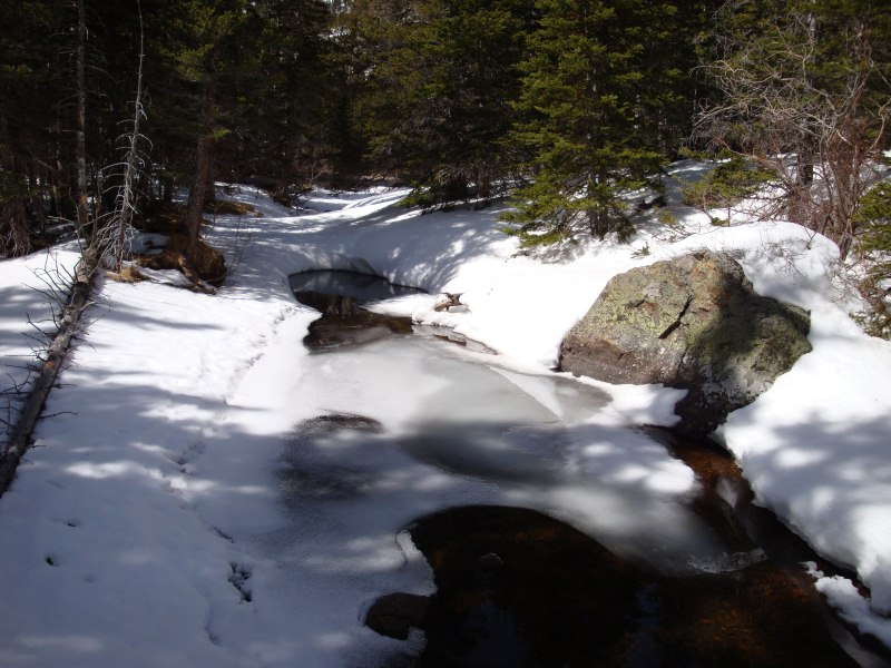
Water Flowing on Glacier Creek
Snowshoe hike in Rocky Mountain National Park near Bear Lake. We went by a couple of frozen lakes and by a snow cover waterfall while following a creek up a valley.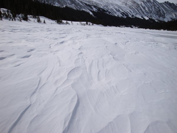
Crusty Snow on Long Lake
A few weeks ago a couple of us went for a snowshoeing hike close to Boulder. The Brainard Lake area is about 35-45 minutes from Boulder. During the winter the road to the lake is closed. The road...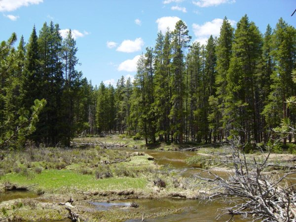
Valley Loop Trail Hike 6-03 - Colorado River 1
This trail is on west side of Rocky Mountain National Park in the headwaters of the Colorado River where it meanders through pine forests and meadows in the Kawuneeche Valley.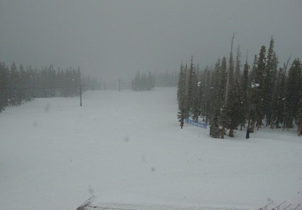
Keystone 4-03 - Looking Down From Top About Noon
Weather can change fast in the mountains. This day, I was snowboarding at Keystone. In the morning the skies were blue and the snow conditions were not good. The snow was hard packed. This first picture is of the North Peak from the top of the front mountain.[img 13]
Looking down a trail at the base area.[img 14]
...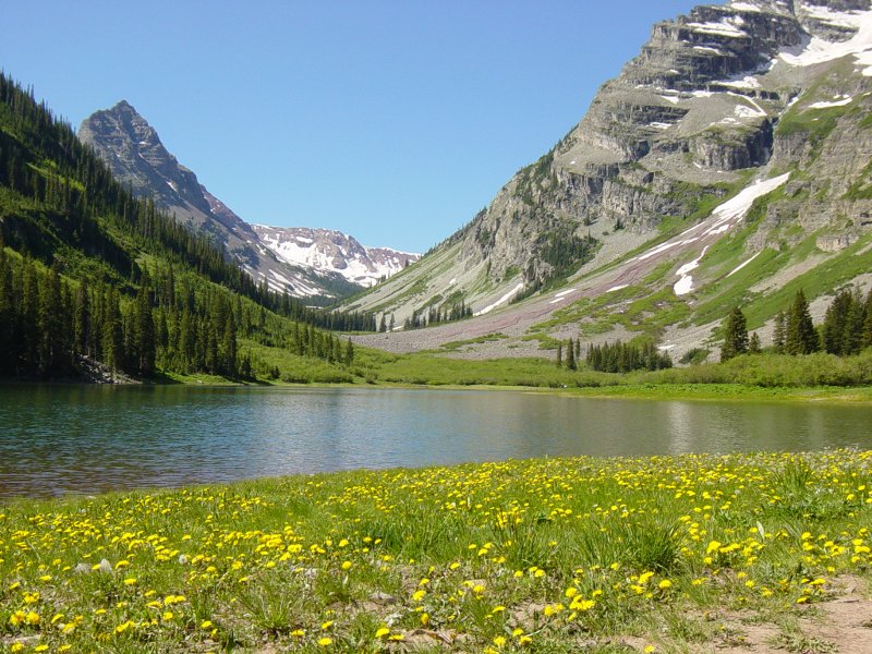
Maroon Bells 6-03 - Crater Lake with Flowers
These pics are from a hike near Aspen, CO, in a valley next to the Maroon Bells. This area is so popular that everyone has to take a shuttle bus in the area during summer days. If you go really early or in the evening the road is open to cars. We hiked up the valley along West Maroon Peak past two alpine lakes. It's a very scenic area. These pic...
Full Post
©2022 - 2026 Mountain Adventures LLC all rights reserved (Designed by On the Grid Web Design LLC)