

This site is photo and video focused combination of hikes, bike rides and other outdoor sports with the occasional visit to a small brewery or winery.
We are also working on offering outdoor sports guiding and coaching.
Biking Utah Colorado Alaska Mountain Eagle Hike MTB Trail Travel Train Creek Glacier
![]()
![]()
![]()
![]()
![]()
![]()
![]()
![]()
![]()
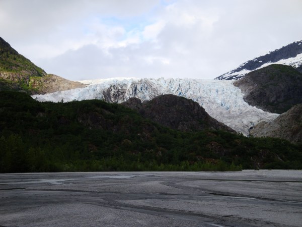
Herbert Glacier
Herbert Glacier Trail (June 2011) July 13, 2011 8:00 PMThe Herbert Glacier trail is an easy 4.5 mile trail about 16 miles north of the Mendenhall Valley in Juneau Alaska. The trail is a compacted gravel trail which many people bike. It follows the Herbert river up to the Herbert Glacier.
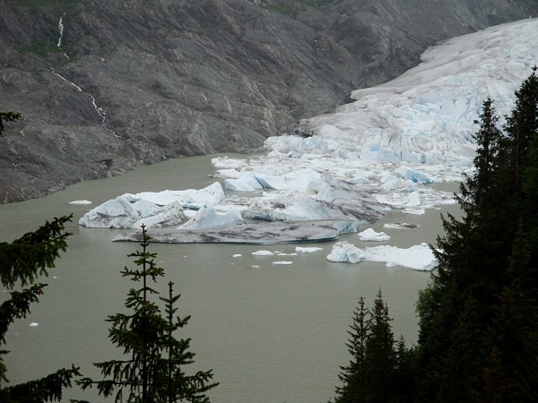
Iceburgs Coming Off the Mendenhall Glacier
This trail starts at the Mendenhall Glacier Visitor center. I took the first left onto the East Glacier Trail. It is a loop trail from which the Nugget Creek trail branches off near the midpoint. The East Glacier trail is well maintained and easy to hike with lots of creeks crossing it.
There is also AJ Falls ju...
Full Post
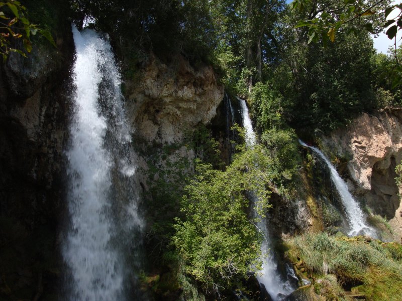
Grand Mesa Trip 8-09 - Rifle Falls
On my way out to Grand Junction last August I stopped by Rifle Falls State Park. About a 20 minute drive from the interstate. It is a small park with a few trails, a campground and of course a triple waterfall.
The trails go to the base of the falls, across the top of them and even behind one of them.
...
Full Post
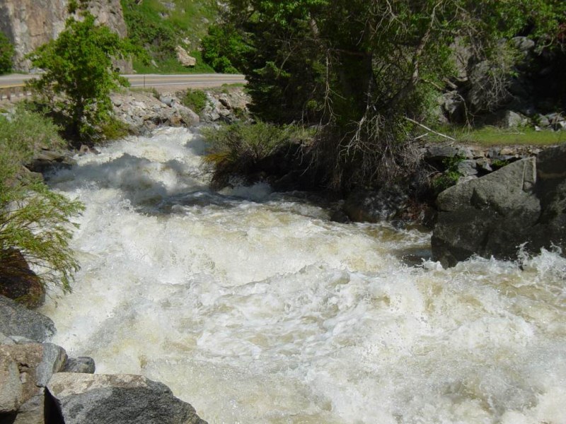
Rapids
A week ago Boulder Creek peaked over 800 cfs. These pics are from when it went up that high six years ago. Some high late May temperatures brought the water level on Boulder Creek up to 800 cfs. Normally it's above 400 cfs. The first three of these pictures are of the creek at 500 cfs in Boulder, a day or two before it went up to 800 cfs. The wa...
Full Post
©2022 - 2026 Mountain Adventures LLC all rights reserved (Designed by On the Grid Web Design LLC)