

This site is photo and video focused combination of hikes, bike rides and other outdoor sports with the occasional visit to a small brewery or winery.
We are also working on offering outdoor sports guiding and coaching.
Biking Utah Colorado Alaska Mountain Eagle Hike MTB Trail Travel Train Creek Glacier
![]()
![]()
![]()
![]()
![]()
![]()
![]()
![]()
![]()
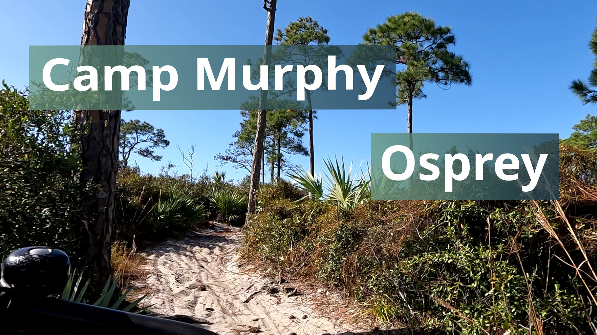
Osprey is a blue trail in the Camp Murphy trails in Jonathan Dickinson State Park. Is this really a blue trail? Felt more like a green. Does anyoe see a trail on the right? I missed a optional side black trail.
Trail Links:
Trailforks
Full Post
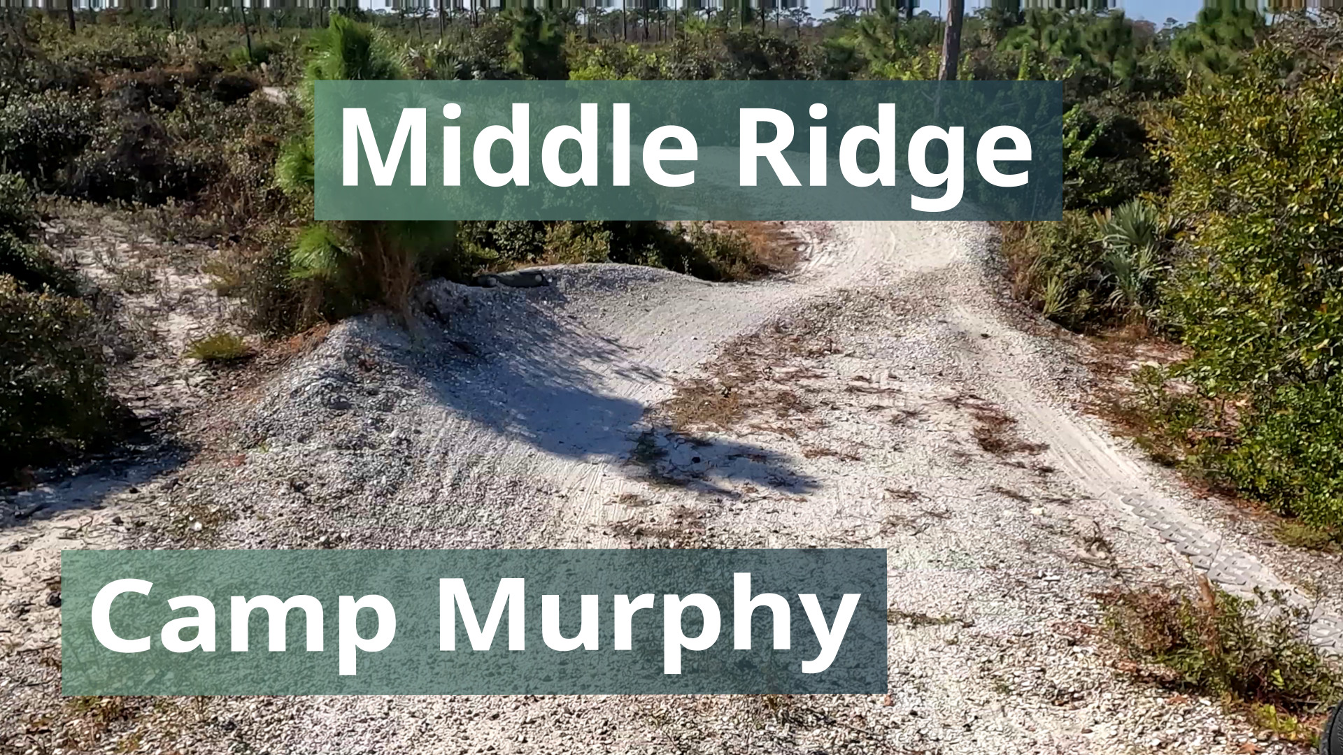
Middle Ridge is a blue trail in the Camp Murphy trails in Jonathan Dickinson State Park. There's berm turns, doubles and table top jumps.
Trail Links:
Trailforks
Full Post
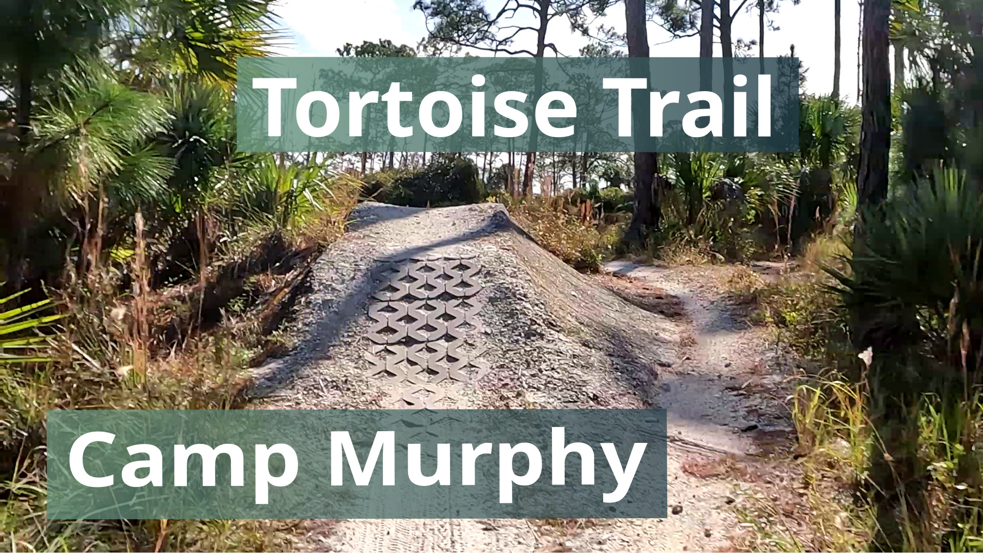
This is the green entrance trail for the Camp Murphy trails in Jonathan Dickinson State Park. Everyone rides this trail to start unless they are going directly to Bunker Hill. With about 25 ft of vertical change, it's a pretty flat trail. To get much air on the jump, you have to pedal hard.
Trail Links:
Full Post
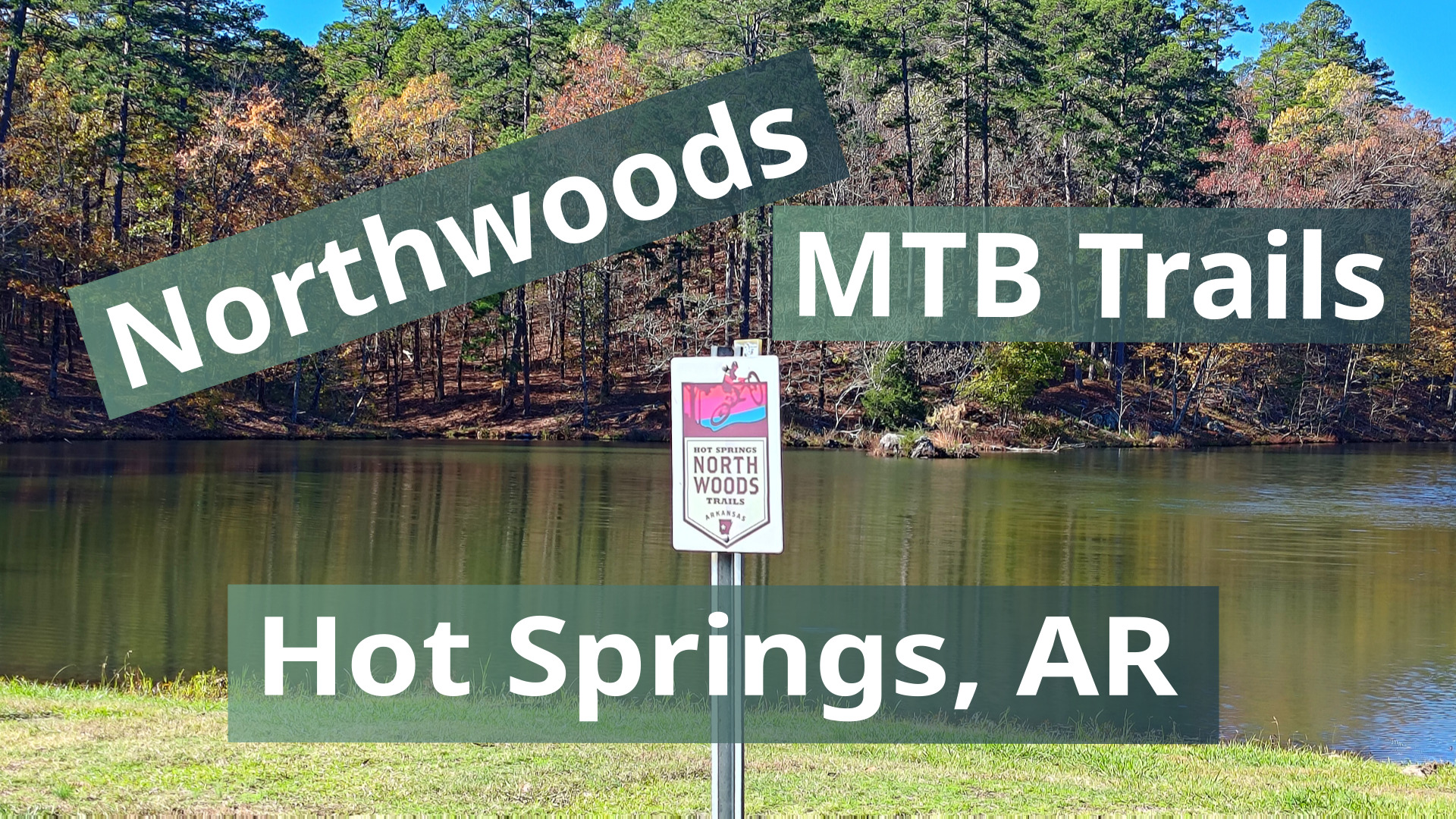
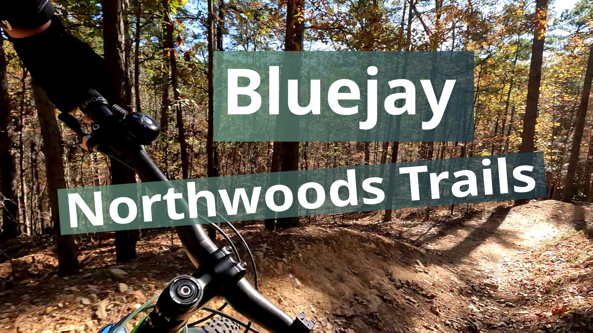
The Northwoods Trails system north of Hot Springs, Arkansas. The system has several downhill flow trails ranging from green to black. They has sweet berms, nice jumps and fun rocks. They are not too long so you could do a few laps on them in day.
Trail Area Links:
Full Post
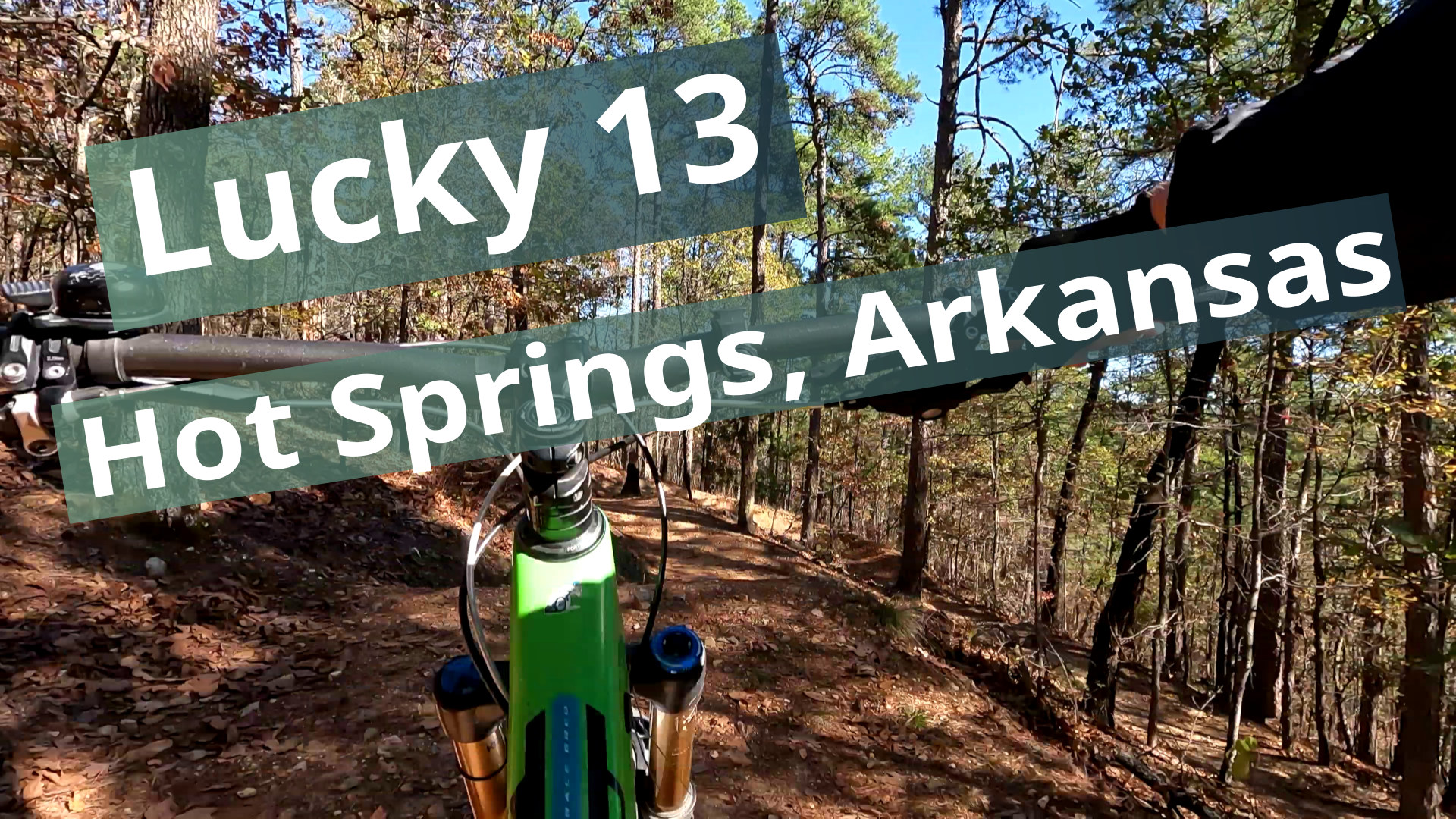
This is an intermediate downhill flow trail in the Northwoods Trails system north of Hot Springs, Arkansas. It has sweet berms, nice jumps and fun rocks. It starts at the same trail junction as Lucky 13, which also runs into Bluejay so a run down either ends together. It's under a mile long and on my ride in the Northwoods system, this and Lucky...
Full Post
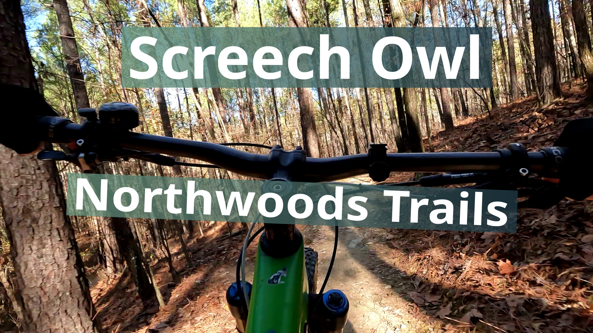
This is a short intermediate downhill flow trail in the Northwoods Trails system north of Hot Springs, Arkansas. It splits off and rejoins the Nighthawk green downhill trail. The video is from the start to the bottom of the downhill so beginning and end of the video has that trail in.
Music: The Creators - Corporate Timeline
This is a downhill flow trail int the Northwoods Trails system north of Hot Springs, Arkansas. It has nice berms and several styles of jumps on this trail including optional gap jumps. It was not hard to follow even with all the leaves. It runs into Bluejay trail at the end which will be in another video.
Music: Bensound- Energy https:...
Full Post
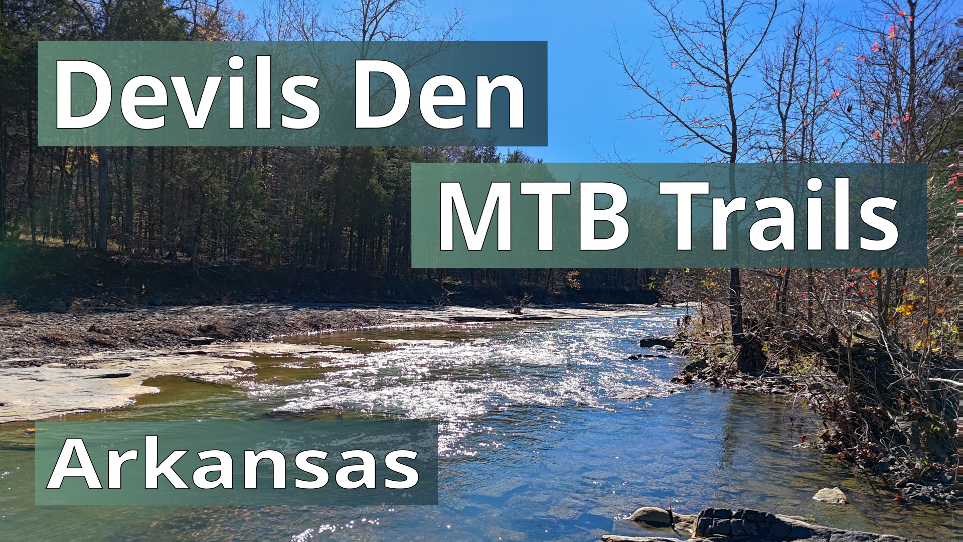
The Fossil Flats trail is called the birthplace of Arkansas Mountain Biking in 1989. That is the loop that you start and end on. This ride also included Sawmill Loop, All You Can Eat, Racer's Hill, We Can Take, Sparky and Orville. Devil's Den State Park is about an hour south of Bentonville, Arkansas.
Due to riding in the middle of Nov...
Full Post
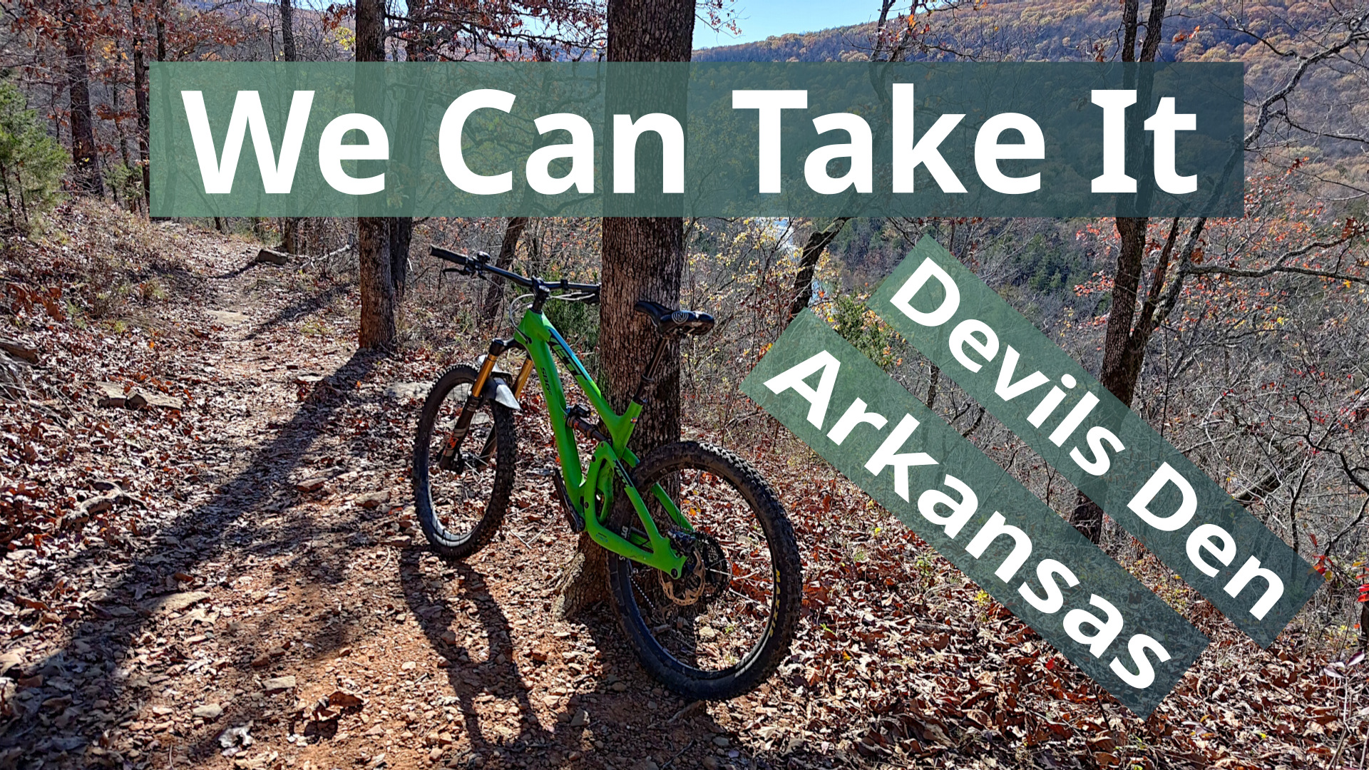
We Can Take It is a cross-country trail in Devils Den Arkansas State Park. It goes along the side of a ridge above other trails. There are lots of spots where you are biking along a rock wall on one side of the trail. Theres also a creek crossing and some good views of the river below. This state park is about an hour south of Bentonville.
...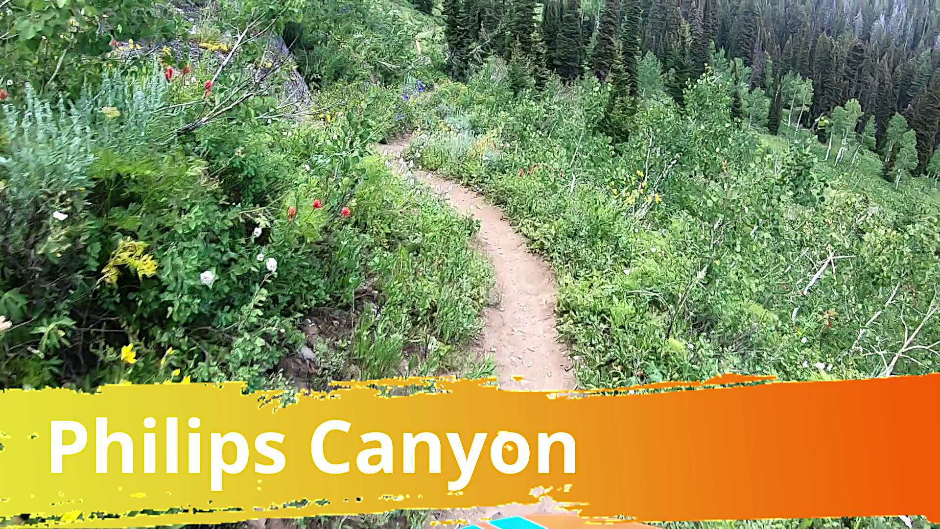
This is the downhill half of the Philips Ridge & Canyon Loop which is near Teton Pass in Wyoming. The start has some of the connector trails between Philips Ridge and Philips Canyon trails. The climb up was a good workout, but the downhill was worth it.
The highlights video from this ride was published a while ago. Recently we decided ...
Full Post
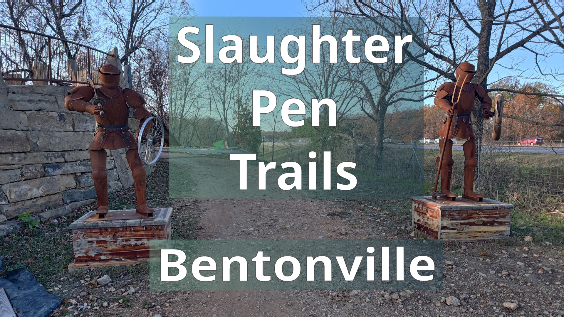
The Slaughter Pen trail system has tons of fun trails in Bentonville, Arkansas. Many are directional with both flow and tech downhill trails. Walmart has donated a lot of money to the trails in Bentonville so theres lots of fun bridges and other features. At the end of video, the trails start at the castle, a medieval themed launching platform.
Full Post
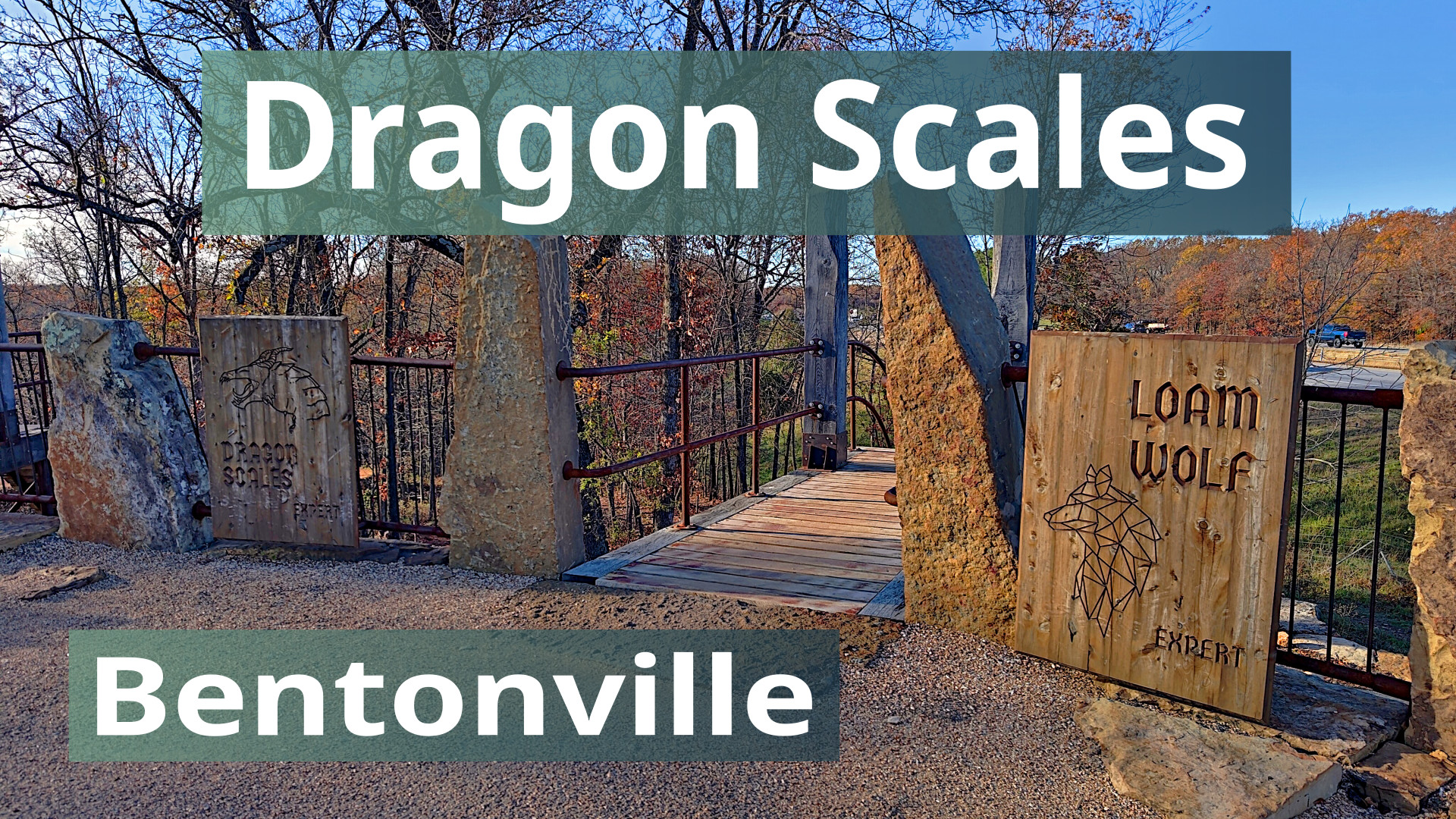
Dragon Scales shares a start with Loam Wolf from the Castle in the Slaughter Pen trail system of Bentonville, Arkansas. I rode Loam Wolf as well, but I didn't get video of it.
Trail Links:
- Trailforks
-
Full Post
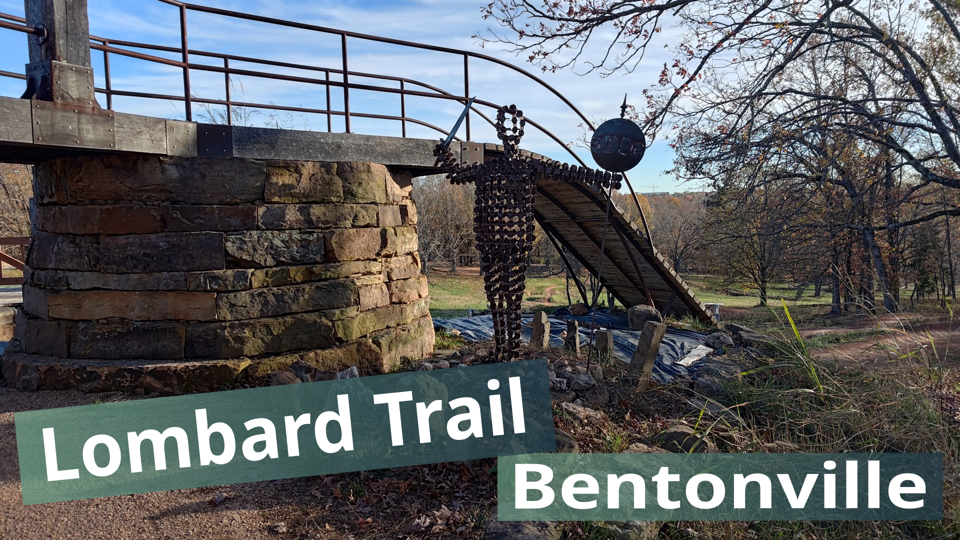
Lombard is the climbing trail to return to the Castle in the Slaughter Pen trail system of Bentonville, Arkansas. Since this is a climb, the video is a time-lapse. Near the top there is a detour due to trail work.
Trail Links:
- Trailforks
-
Full Post
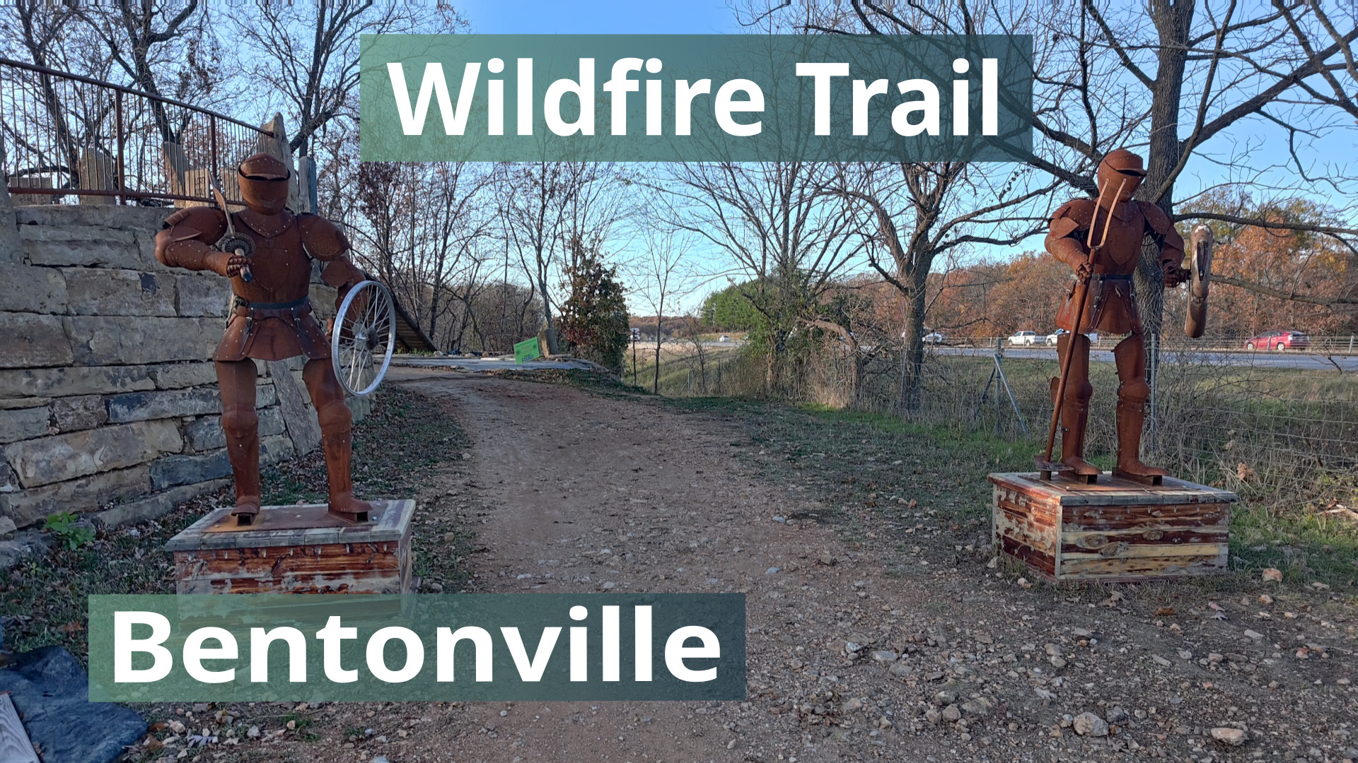
Wildfire is a short beginner downhill flow trail starting from the Castle in the Slaughter Pen trail system of Bentonville, Arkansas.
This is from my first trip to Bentonville and all the videos in this set are my first time down the trails.
Trail Links:
-
Full Post
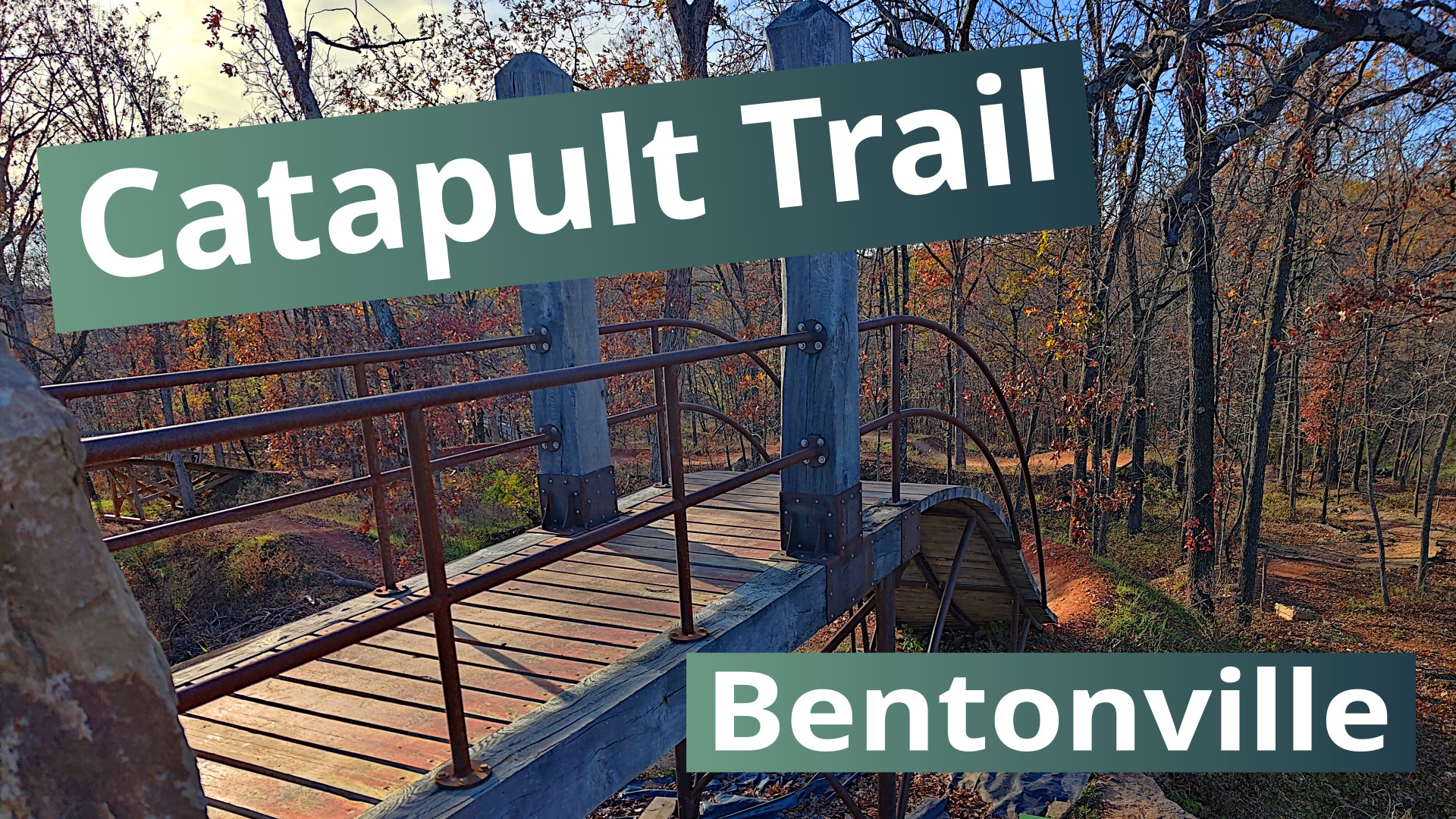
Catapult is an intermediate downhill flow trail starting from the Castle in the Slaughter Pen trail system of Bentonville, Arkansas. It has lots of wood bridges going over the other trails that also start from the castle. You don't have to get air, but you could.
Trail Links:
-
Full Post
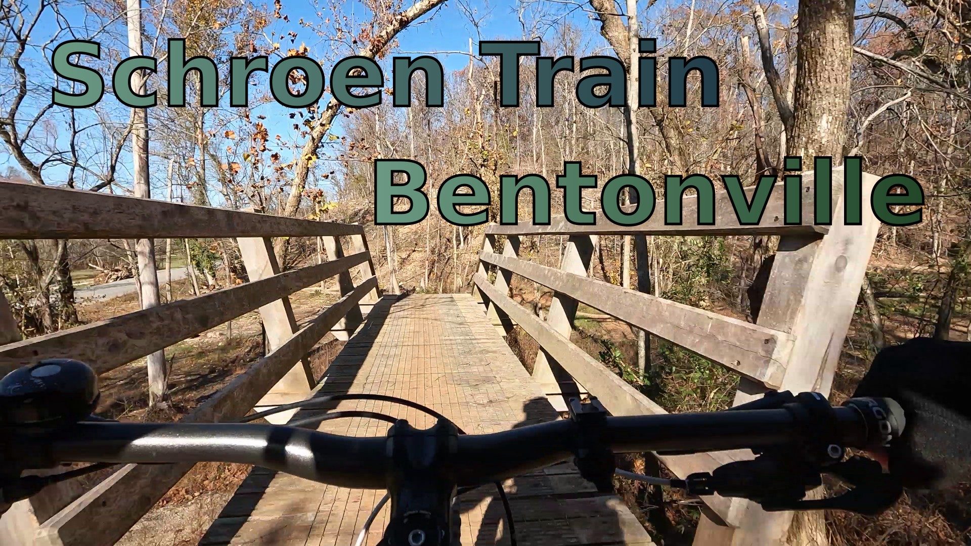
Schroen Train is a downhill flow trail in the Slaughter Pen trail system of Bentonville, Arkansas. It has berms, wood bridges and a rocky tech section. This video is showing the downhill part. There's another part that is the climb up to a junction where the fun begins.
Trail Links:
-
Full Post
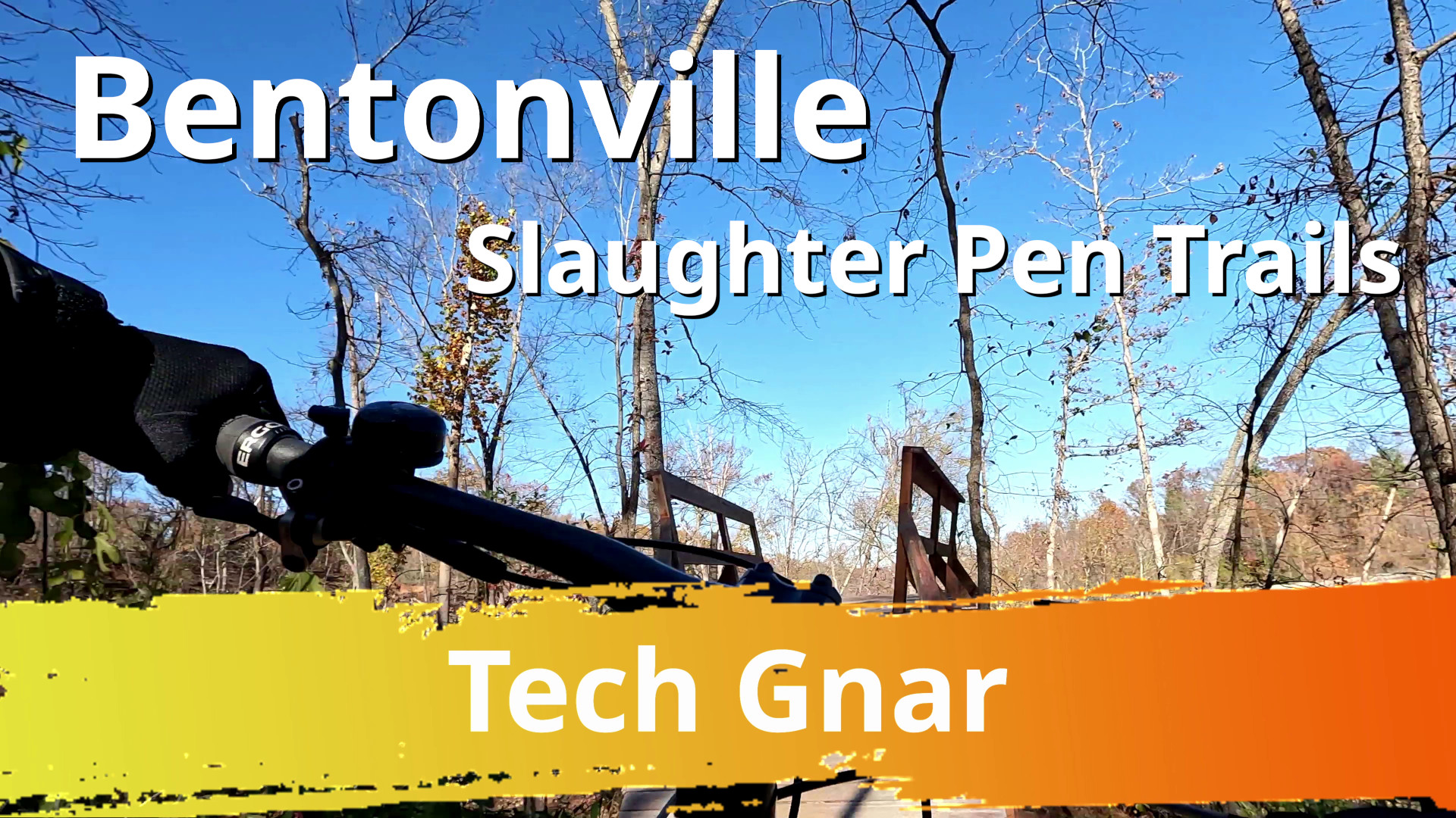
This is a full trail video of Tech Gnar in the Slaughter Pen trails. It starts at the Tech Hub just north of the Flow Hub. It's a black trail with a couple of wood features.
Trail Links:
- MTB Project
-
Full Post
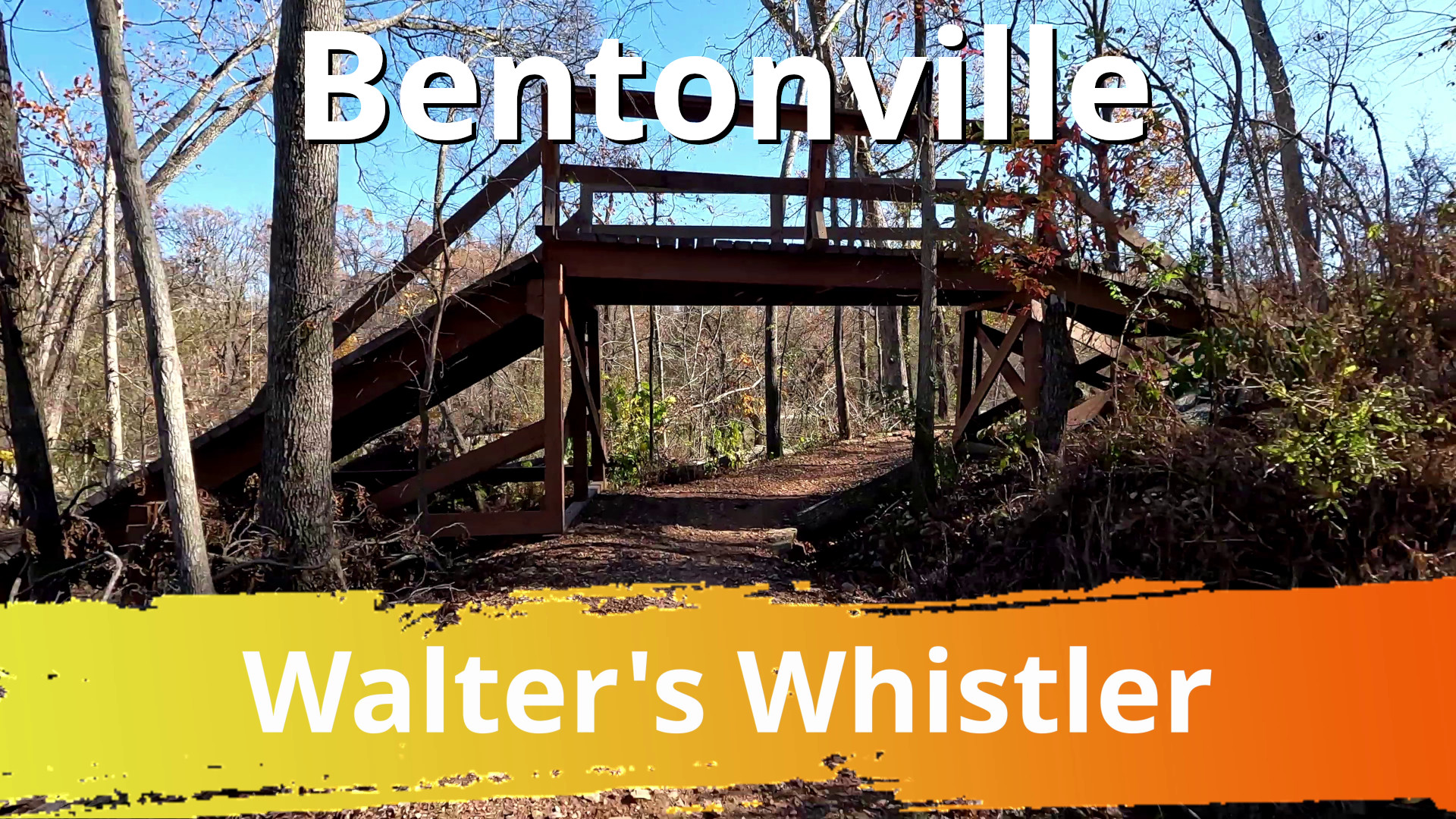
This is a full trail video of Walter's Whistler in the Slaughter Pen trails. It starts at the Tech Hub just north of the Flow Hub. It's a green trail with some berms that's good as a warmup and lets you see some of the other trails coming down from the Tech Hub. At the end there's a bit of an elevated side trail after it merges into Rocking Hors...
Full Post

These three trails start at the Flow Hub in the Slaughter Pen Trail system. They are on the south side in the phase 3 area. All three are short, taking about a minute each to ride down. The first one, Boo Boo, is full of berms and small jumps. The second trail, Choo Choo, was a paved one - basically asphalt berms. The last one, Moo Moo, is a gre...
Full Post
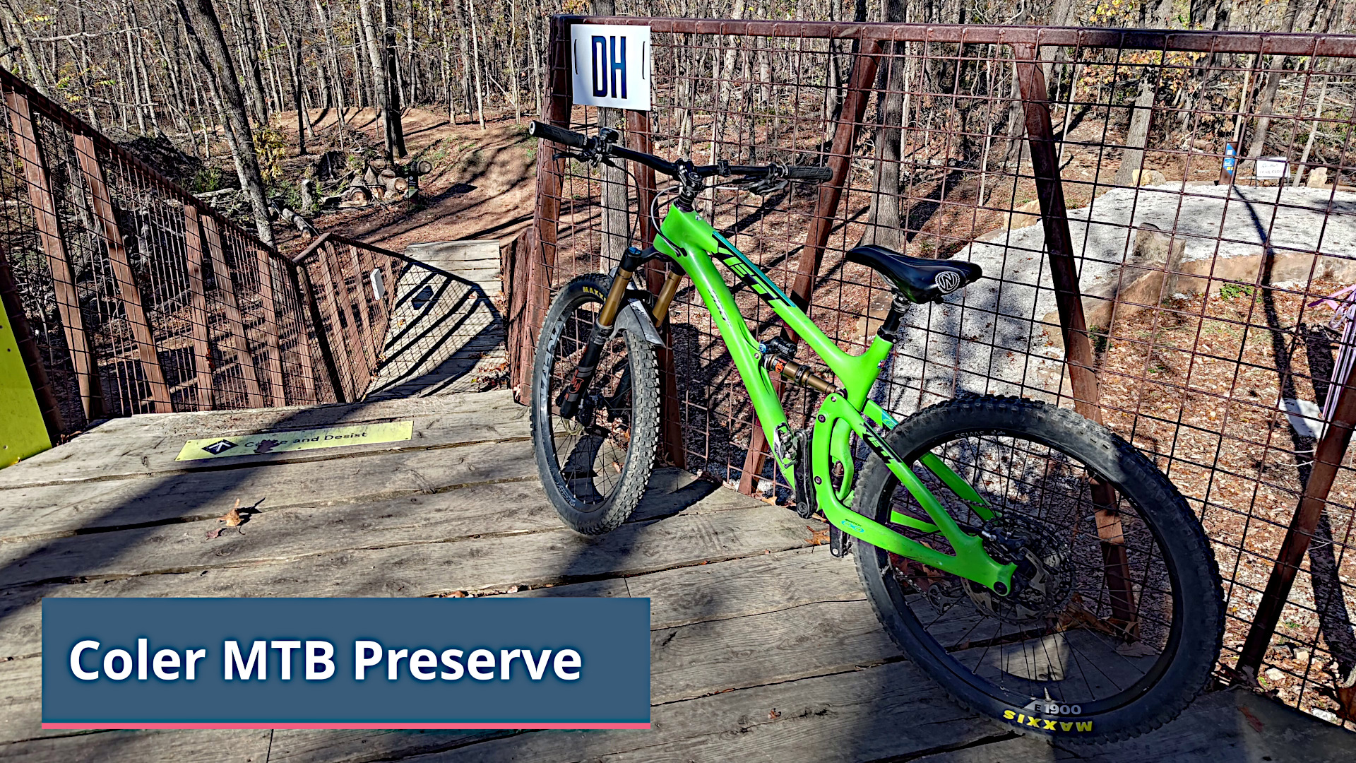
Coler MTB Preserve has a mix of levels and types of trails. On the north side there's a few downhill trails starting from The Hub which are the ones at the start of the video. Then I made my way to the other side of the preserve to Thunder Dome dual slalom race track and ended the ride in the middle down on the Hardway to Cafe trail. This was my...
Full Post
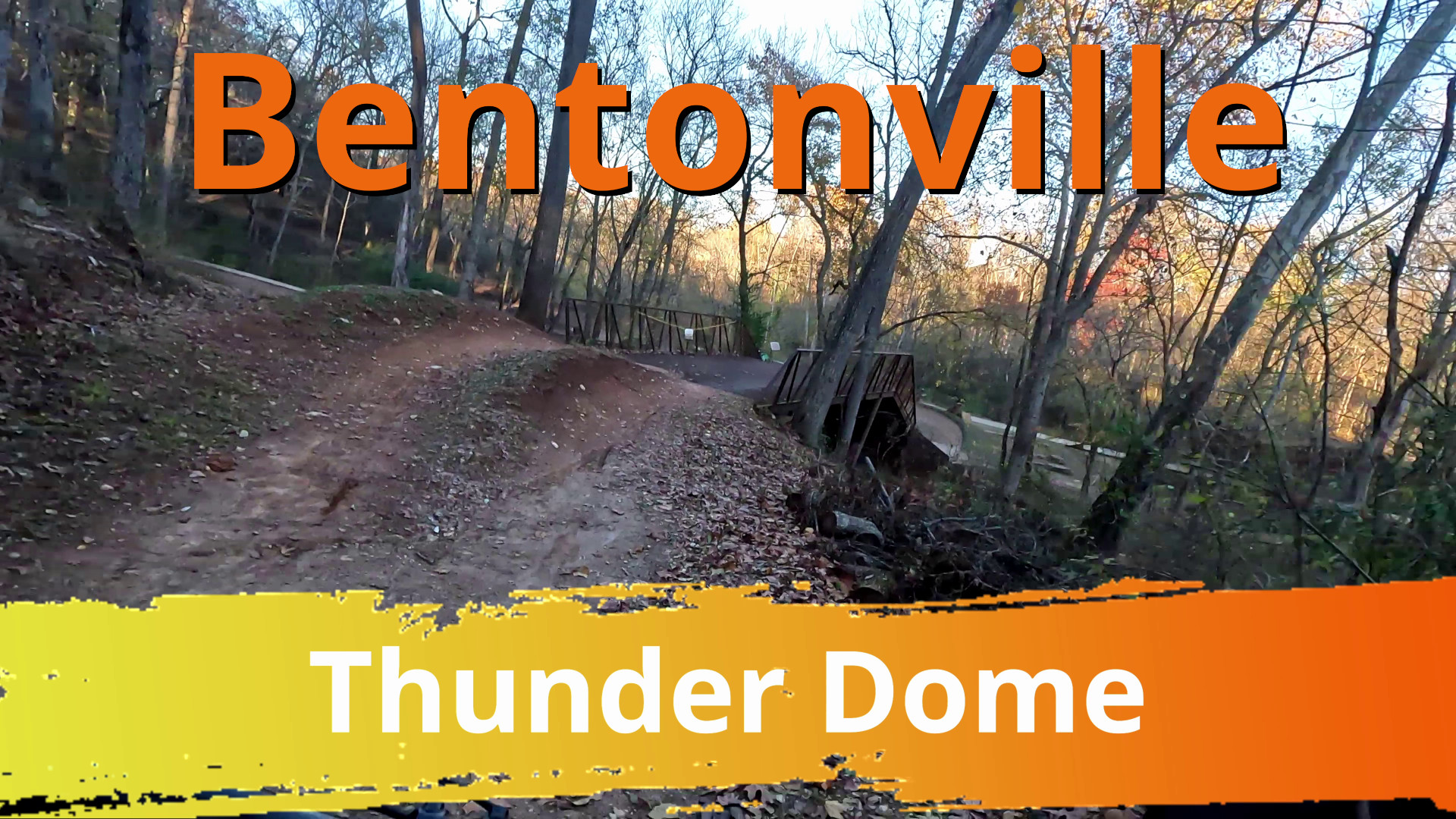
Thunder Dome Trail
Thunder Dome is a dual slalom race track in the Coler Mountain Bike Preserve. This is on the opposite side of the park from the other trail videos from this trip.
Trail Link: Trailforks
Music: Motion Array - Power Up
Video Taken: No...
Full Post
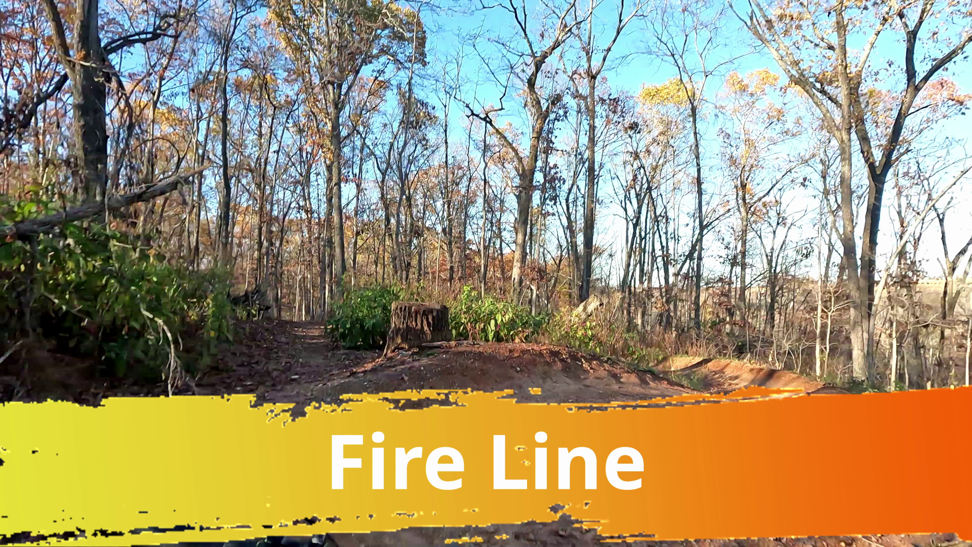
Fire Line is a blue flow trail with lots of jumps that starts at the hub in the Coler Mountain Bike Preserve. This is the last of 5 videos I recorded when starting from the hub. It was my first time riding all of them.
Trail Link: https://www.trailforks.com/tr...
Full Post
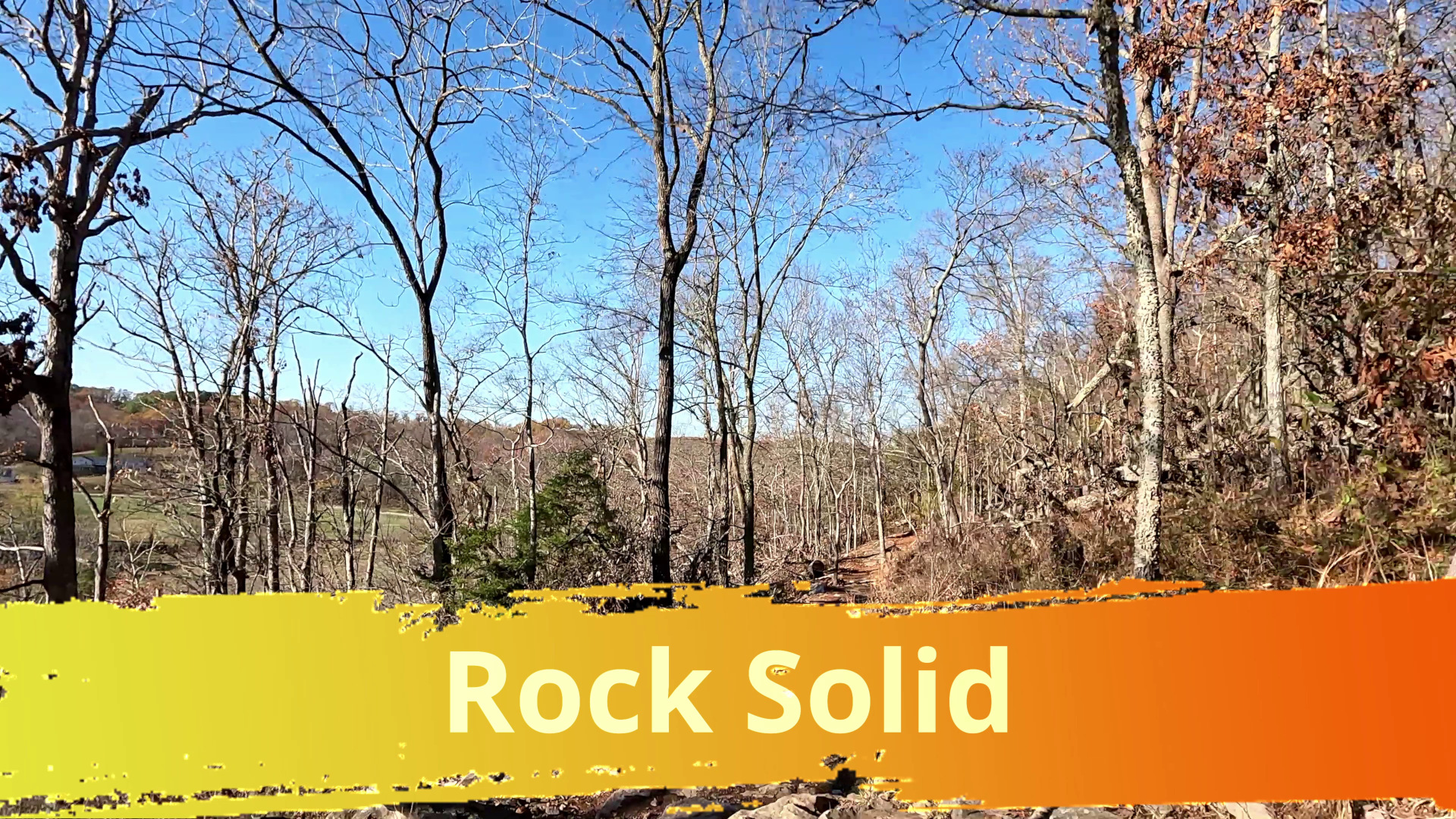
This is was to be a full trail video, but the video gets cut off. The part that got got cut off though was lots of tires slipping on wet rocks and walking that would've been edited out. I'll just have to go back sometime when the trail is dry.
Rock Solid is a double black tech trail that starts at the hub in the Coler Mountain Bike Pre...
Full Post
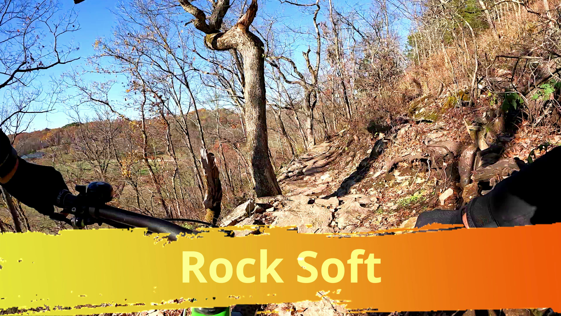
Rock Soft Video Thumbnail
This is a full trail video, but it's been sped up (aka I had the Gopro on the wrong mode). I wish I could bike that fast. I decided to make a video of it anyway and mix it with some short funny video music.
Rock Soft is a tech trail that starts at the hub in the Coler Mountain Bike Preserve. Along with Rock Salad and Rock Hard it's a f...
Full Post
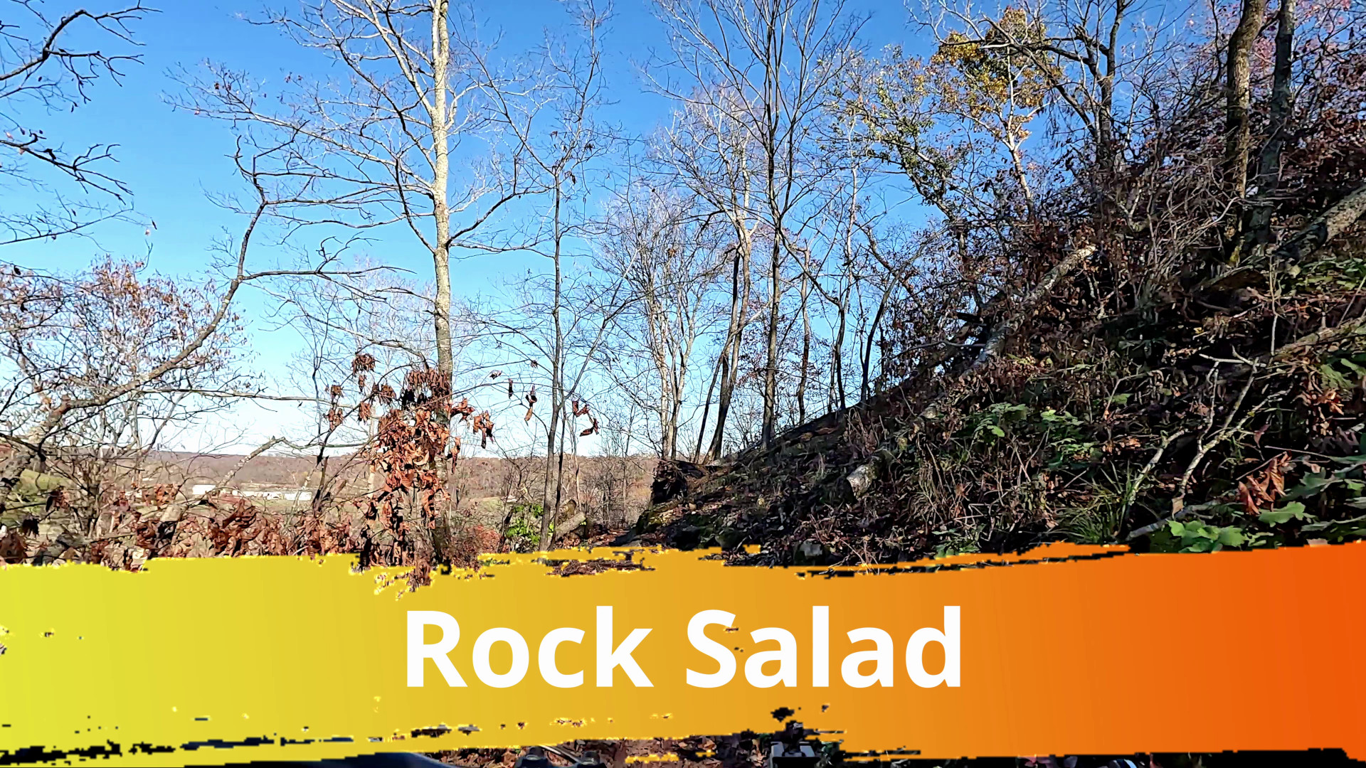
Rock Salad Video Thumbnail
Rock Salad is a tech trail that starts on the climbing trail (Pedal Assist) up to the hub in the Coler Mountain Bike Preserve. This is a full trail video, but I did cut out a couple spots where my tires slipped on wet rocks and I stopped.
Trail Link:https://www.trai...
Full Post
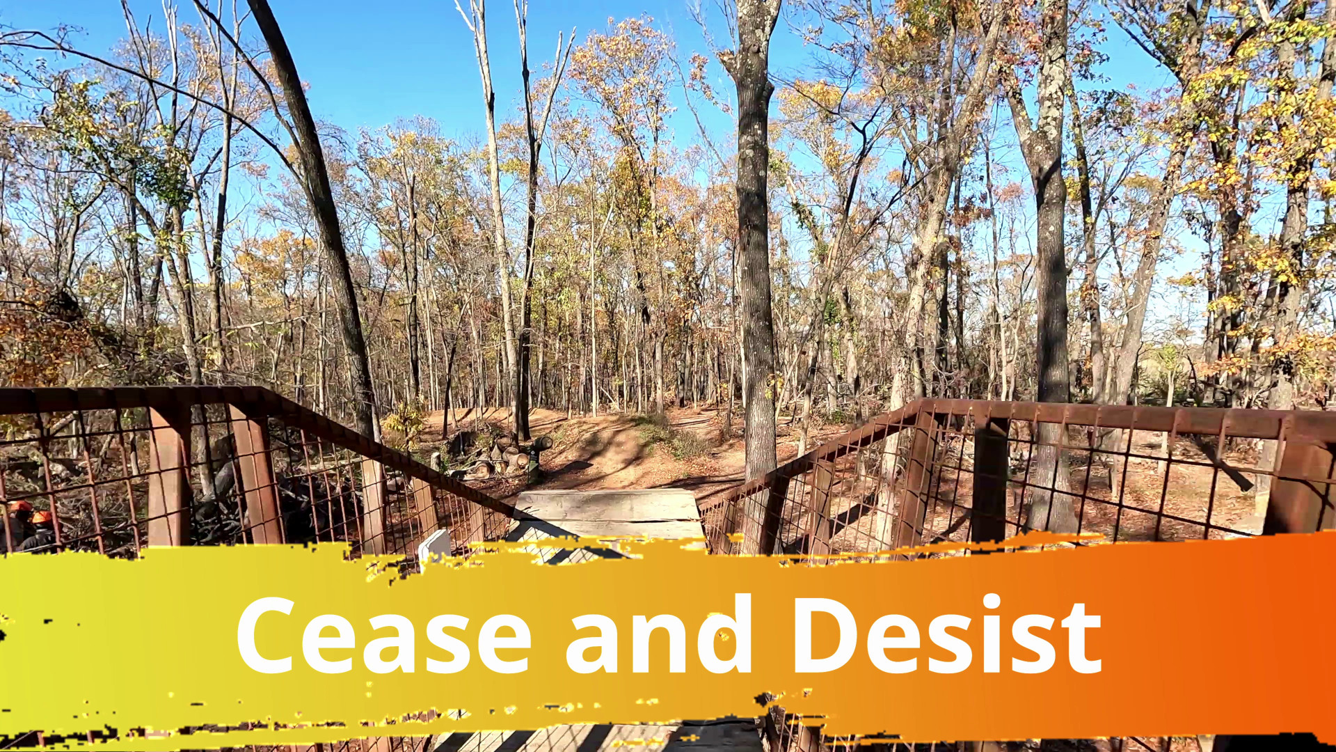
Cease and Desist Trail Vdeo
Cease and Desist is a jump trail starting at the Hub. This was my first time down it and the first downhill flow trail I did in the Coler Preserve.
Trail Link: https://www.trailforks.com/trails/cease-and-desist-85154/
Music: Motion Array -...
Full Post

Naturita Ridge
Desert riding going up to a ridge between two valleys in Colorado. This is actually a route of several doubletrack trails and roads, even though it shows as a single trail on Trailforks, that are also open to atvs and dirt bikes. There wasn't any real hard technical sections, but a fun scenic exercise loop with some rockiness.
Trail Li...
Full Post
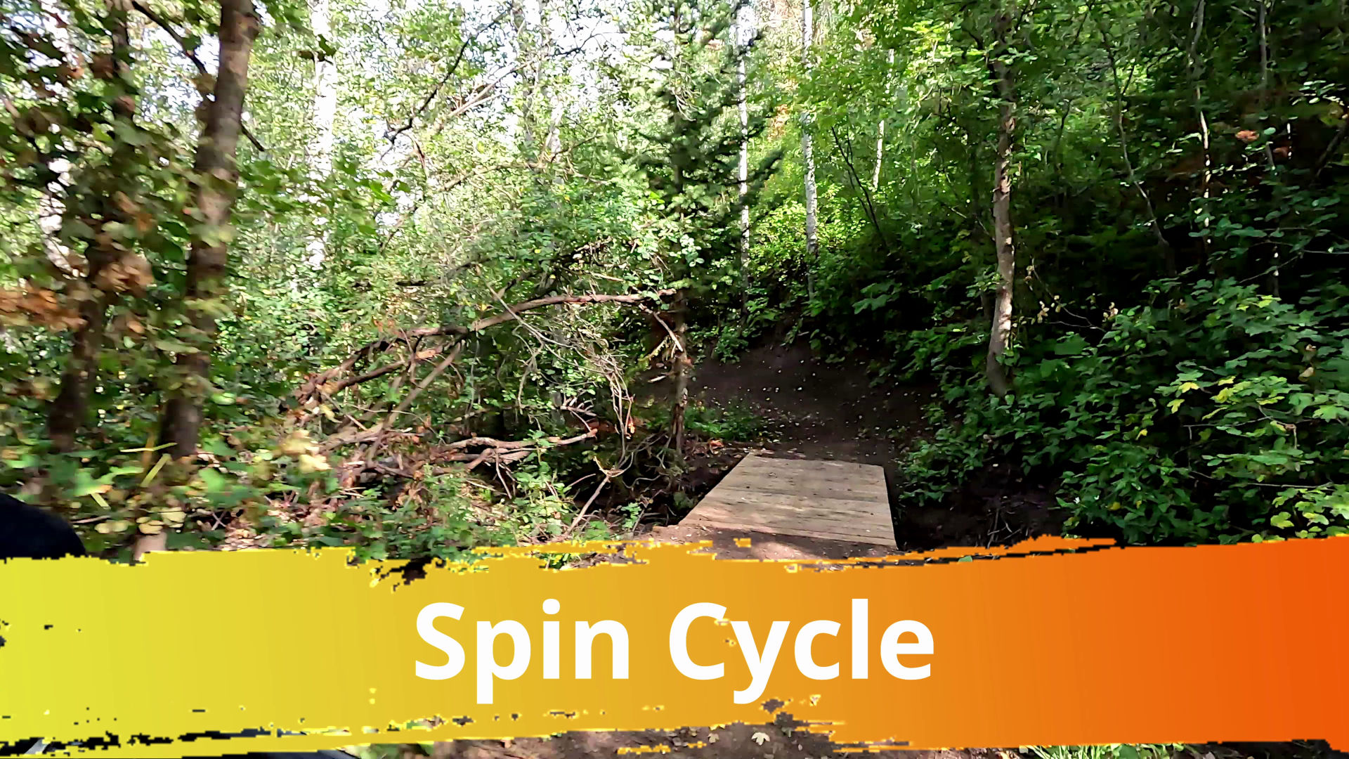
Spin Cycle Trail
Spin Cycle is fun twisty downhill trail near Park City, Utah. Its grand finale is in a gully with big banked turns and creek crossings. In the gully section, there are a few spots where work was being finished up and a couple of downed trees. I left the climbing section in, but sped it up 5x. Spin Cycle has a new climbing trail, Rinse Cycle, nex...
Full Post
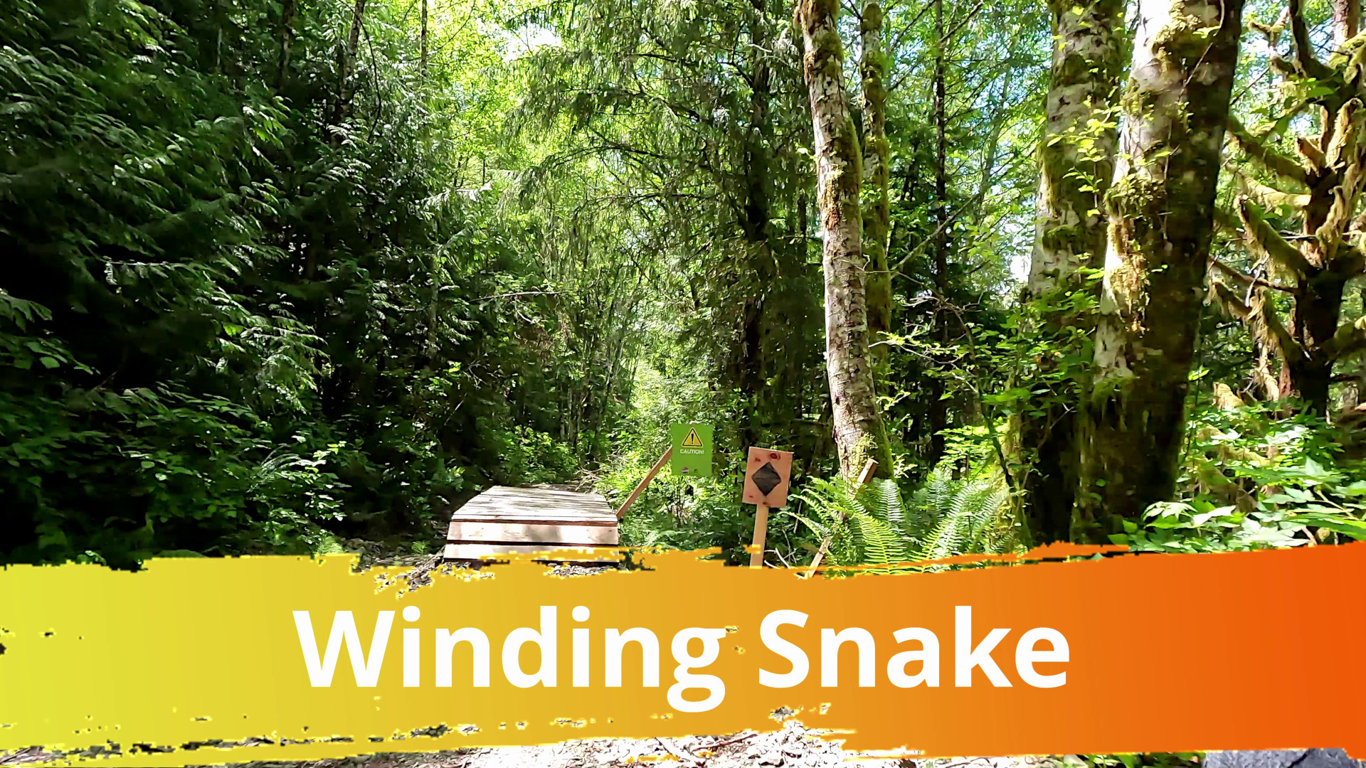
Winding Snake, Ucluelet, BC
citxaa iyii (Jit-hwah Hy-eee) transalted as Winding Snake is another downhill flow trail at the base of Mt. Ozzard. It is on Vancouver Island near the town of Ucluelet, BC and Pacific Rim National Park. Like citkaaatas (Rolling Downhill) next to it, short trail at 2,0500 ft long with 200 ft of descent, but it's a lot of fun packed in there. Ther...
Full Post
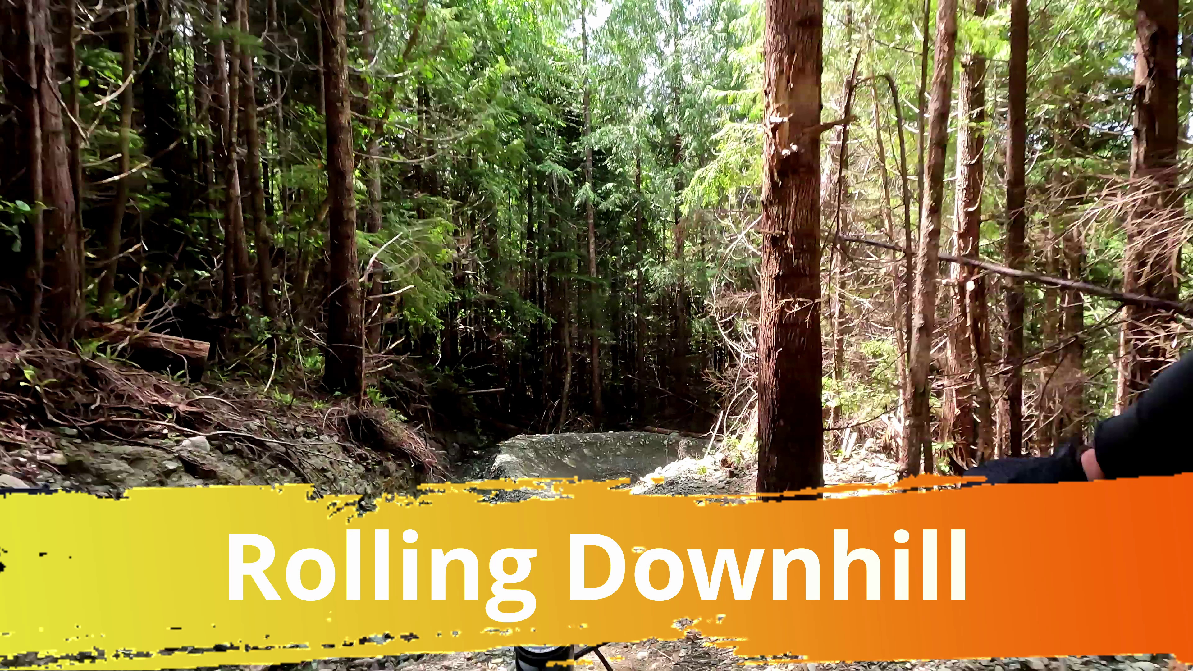
Rolling Downhill, Ucluelet, BC
citkaaatas (sitk-augh-a-tus) transalted as Rolling Downhill is a downhill flow trail with jumps. It is on Vancouver Island near the town of Ucluelet, BC and Pacific Rim National Park. It's a newer trail than was opened last year. It's a short trail at 1,900 ft long with 150 ft of descent, but it's a lot of fun packed in there. The area has two o...
Full Post
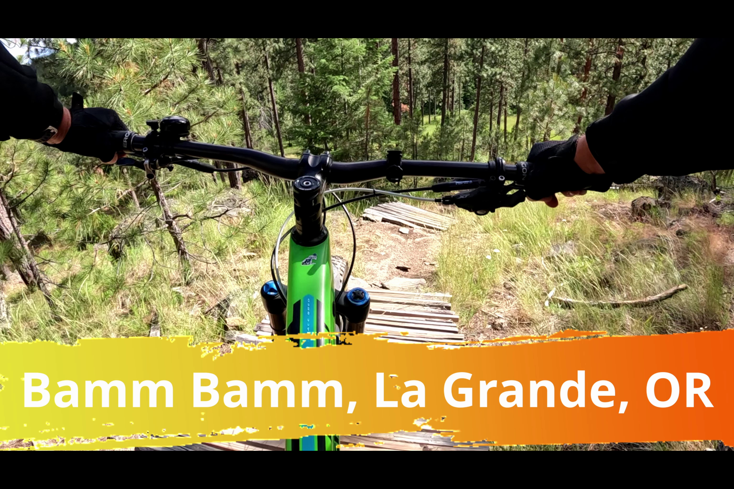
Bamm Bamm Trail
Bamm Bamm is a black diamond downhill trail in the Mount Emily Recreation Area north of La Grande, OR. It's a short trail, only 2600 ft long, near the bottom parking area, so it's good for a quick lap. It has a bunch of jumps, small drops and wood features. This was my first time going down the trail.
Trail Link:
Full Post
This is the downhill half of the Philips Ridge & Canyon Loop which is near Teton Pass in Wyoming. The start has some of the connector trails between Philips Ridge and Philips Canyon trails. Philips Canyon trail is almost all downhill. The climb up was a good workout, but the downhill was worth it.
Music: Kevin MacLeod - Not As It Seems (http://... 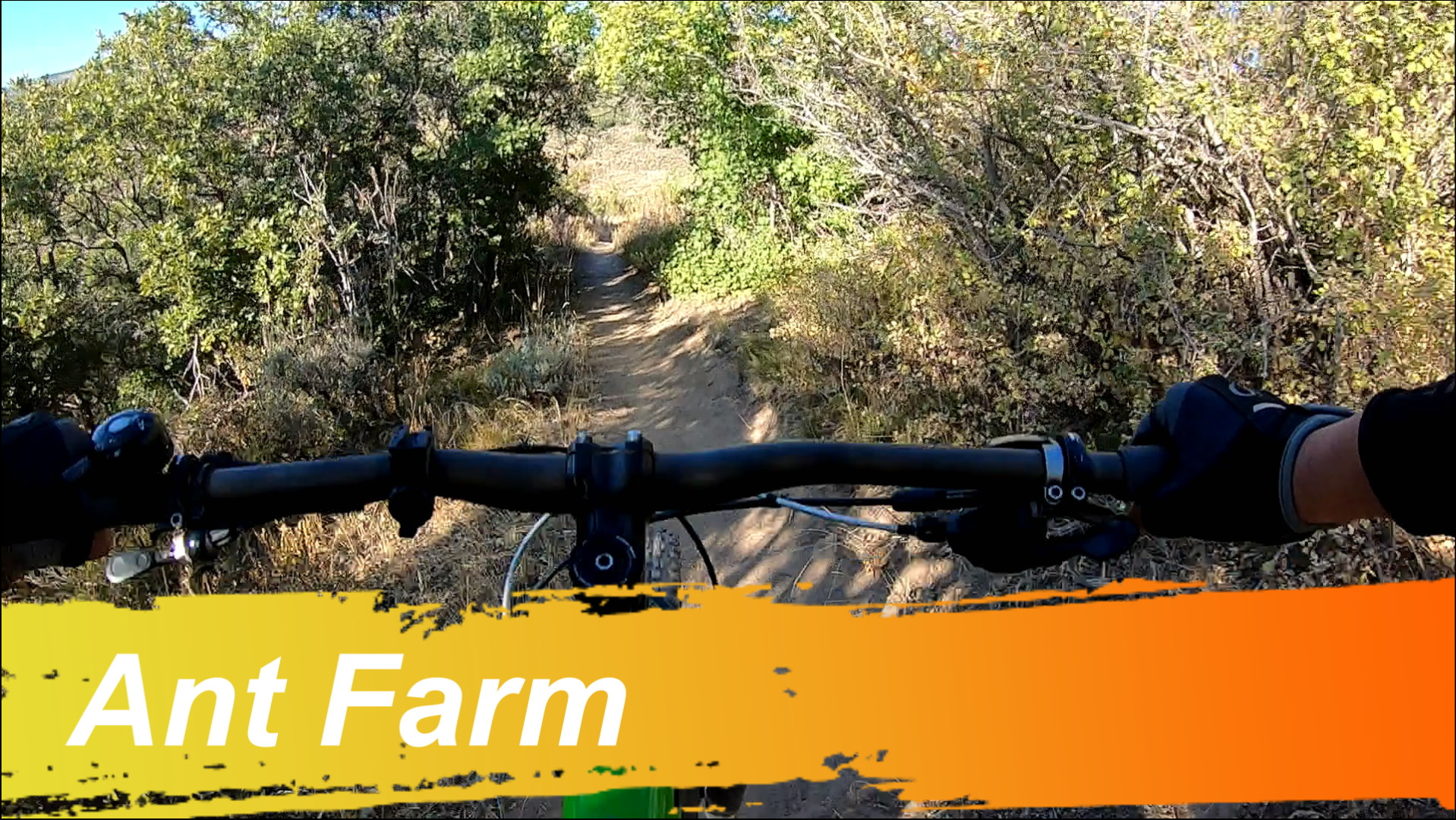
Ant Farm
Ant Farm trail was rebuilt in 2018. It is one of four downhill flow trails in Bob's Basin. The rebuilt improved the flow and little drops and side hits.
Trail Link>https://www.trailforks.com/trails/ant-farm/
Music: Kevin MacLeod - Big Rock (
Full Post
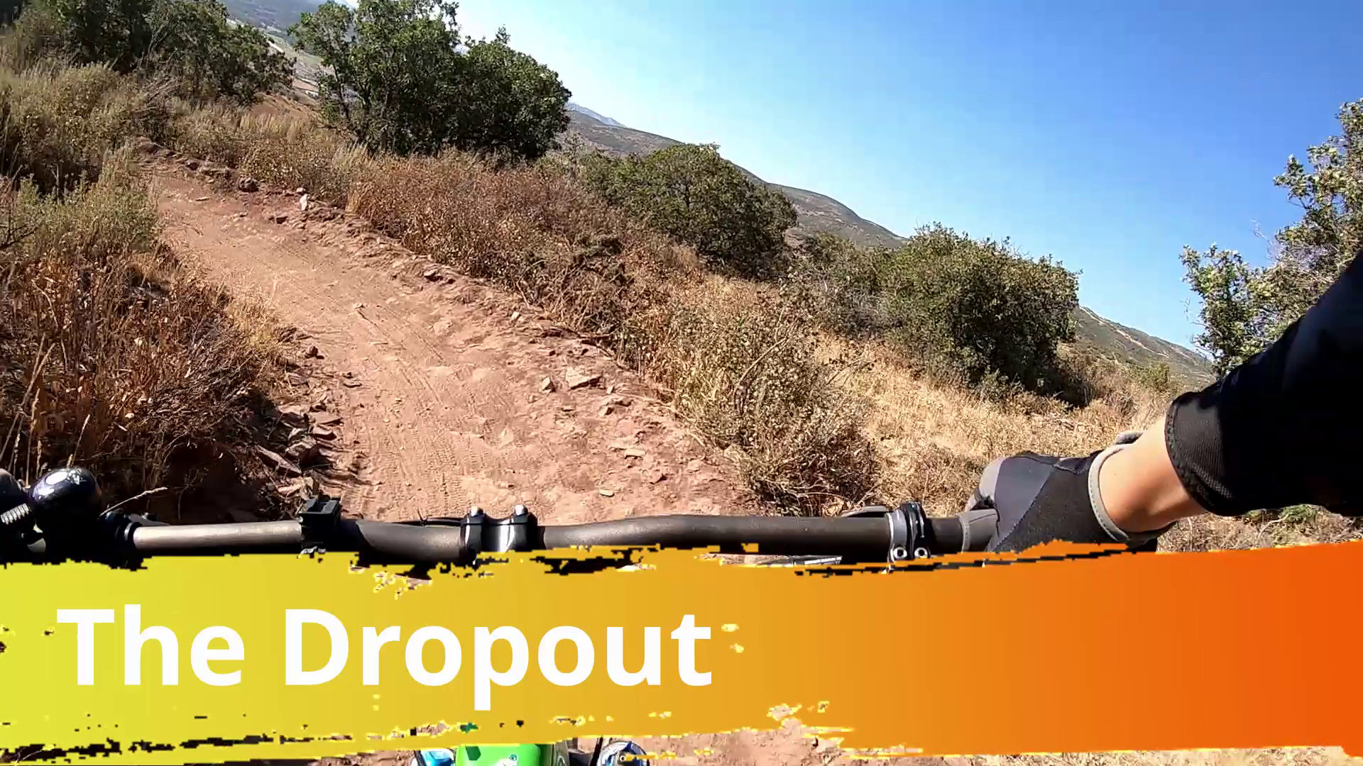
The Dropout trail was rebuilt in 2019, a year before this video. It is one of four downhill flow trails in Bob's Basin. The rebuild improved the flow and added doubles.
Music: Birth of a Hero, https://www.bensound.com (Creative Commons License)
Flume Trail
Most of this ride was on the Flume Trail with the upper section on Wild Iris loop. There was a mix a stuff on the ride, smooth trail, rock gardens, steep downhills and lots of views of the river. The GoPro on top of my helmet hit a overhanging tree I didn't see it and the camera saw it a few frames before getting hit.
This is was recor...
Full Post
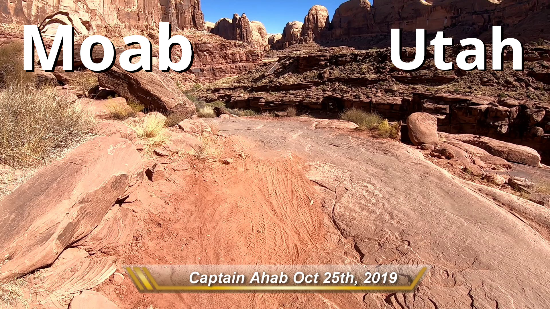 Highlights of my ride on the double black Captain Ahab trail in Fall 2019. It's one of the best techy trails in Moab.
This is an older video not published here before. It was take using a Mero 6 which explains the jerkyness not in my newer videos.
Audio: Big Rock by Kevin MacLeod (http://incompetech.com)
Video Taken: October 25th, 2019
Highlights of my ride on the double black Captain Ahab trail in Fall 2019. It's one of the best techy trails in Moab.
This is an older video not published here before. It was take using a Mero 6 which explains the jerkyness not in my newer videos.
Audio: Big Rock by Kevin MacLeod (http://incompetech.com)
Video Taken: October 25th, 2019 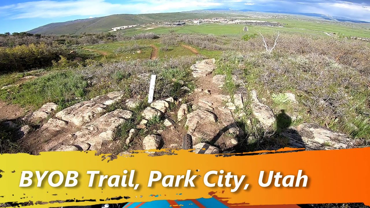
BYOB is a downhill trail off the RTS loop.
Trail Link>https://www.trailforks.com/trails/byob/
Music: Inspire from BenSound (https://www.bensound.com, Creative Commons License)

OMH is downhill trail in the Lower Utah Olympic Park area that was built in 2018.
Trail Link>https://www.trailforks.com/trails/omh/
Music: Summer from BenSound (https://www.bensound.com, Creative Commons...
Full Post
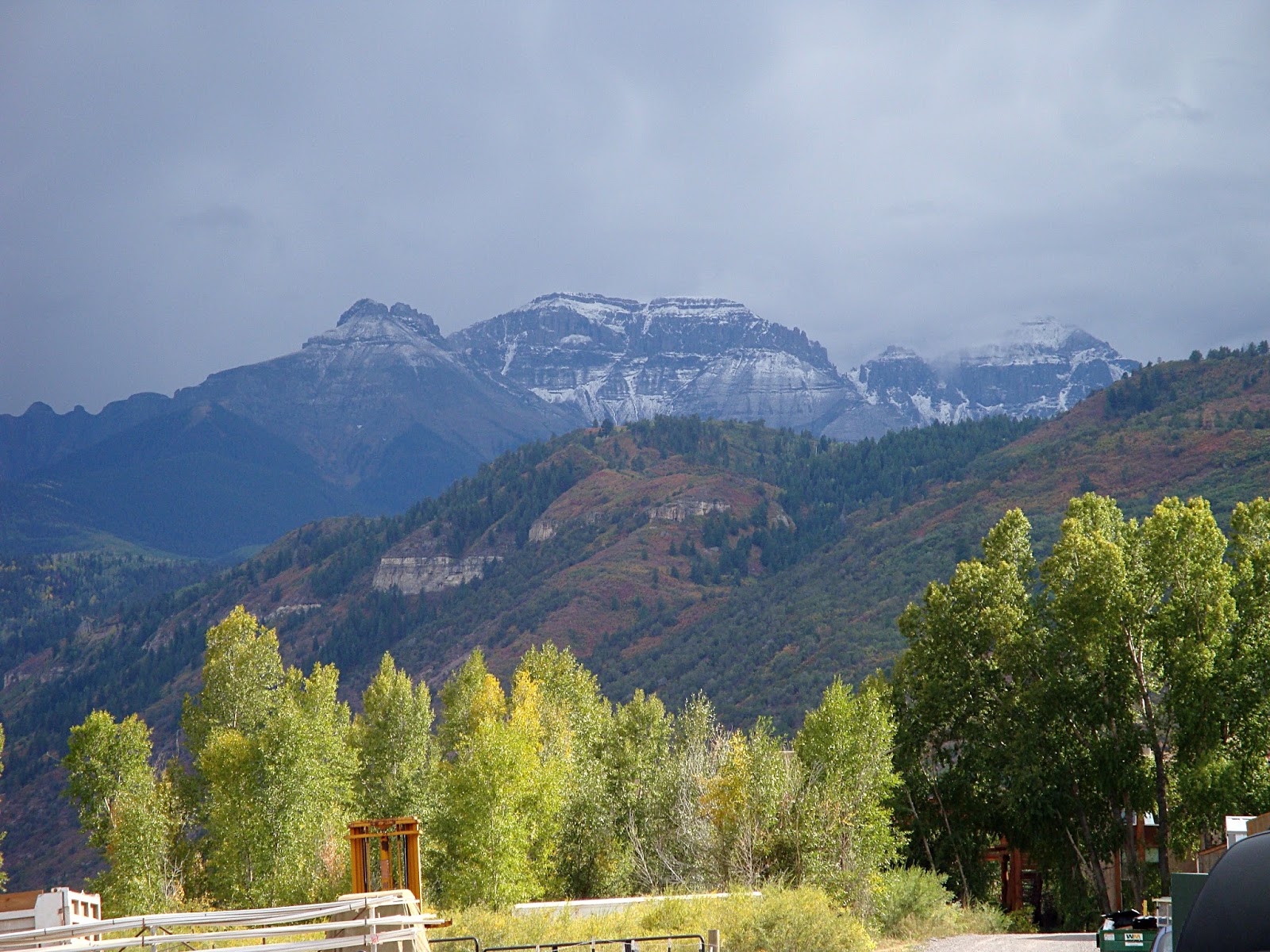
Ridgeway Has Some Nice Views of the Nearby San Juans
This is the last of the three articles I wrote for the website Trazzler which is no longer. It's not a ride or hike, just a stop we made on a rest day between climbing 14ers. Photos are from a trip in 2009For most, the town of Ridgeway is where your turn to go to Telluride or go straight to Ouray. Just off the main road, theres the Co...
Full Post
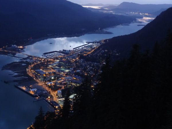
Downtown Juneau at Night
Head up a mountain right off the boat! The Mt. Roberts Tram is by the cruise ship docks in downtown Juneau and takes passengers up 1,745 ft to the top of Mt. Roberts. It is run by an Alaskan native owned corporation. On the way up and on top there are excellent views of the the downtown area and of Douglas Island.
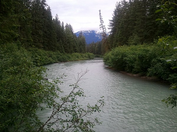
The Eagle River
This trail is much rougher than the nearby Herbert Glacier trail, even though they start near each other. It follows the Eagle River toward the Eagle Glacier.
The Eagle River
Much of this trail (like many in the area) is on boardwalks. They vary from planks o...
Full Post
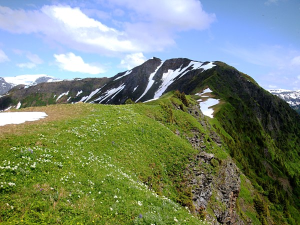
Heintzleman Ridge
Thunder Mountain is not far from the shore and forms part of the once side of the Mendenhall Valley. There are two trails up the mountain which merge about half way up. The one I took is from the valley and is rougher. The trailhead for this trail is about a quarter mile from where I'm living now. There are is an short wetlands ecology trail the...
Full Post
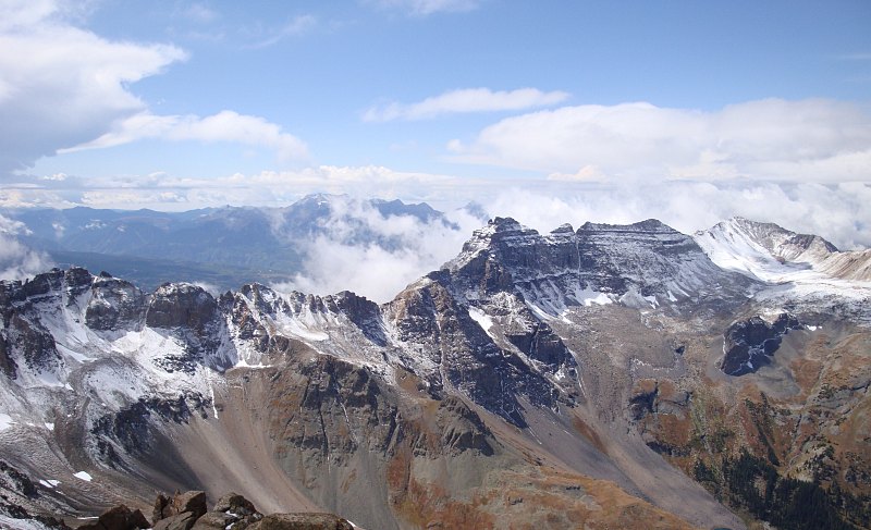
San Juans Trips 9-09 - View When the Clouds Had Cleared
(San Juans - Part 3)Mt. Sneffels is third highest mountain in the San Juans, 14,150 ft. The hike up it is short, but steep and fun. The drive from Ouray to the trailhead was very scenic and part of it is a shelf road with amazing views.
Overhanging Rock
...
Full Post
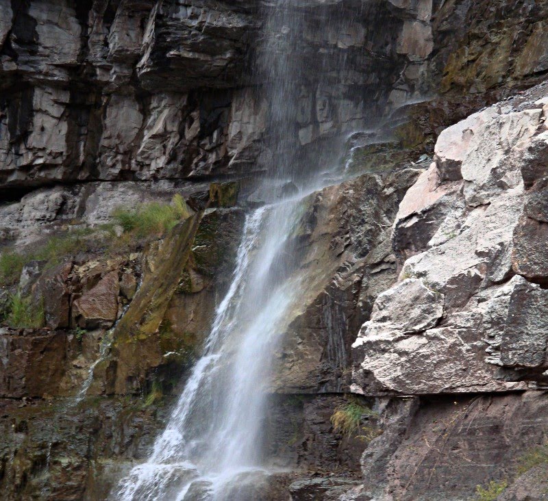
San Juans Trips 9-09 - 57 Cascade Falls
(San Juans - Part 2)We had pulled into camp after dark, so we didn't realize the view that our campsite had. When we got up the next morning, this is the view that awaited us.
This was our rest day, so we just did stuff around Ouray. We went to the Box Canyon Falls. Unfortunately, I was not able to get any good p...
Full Post
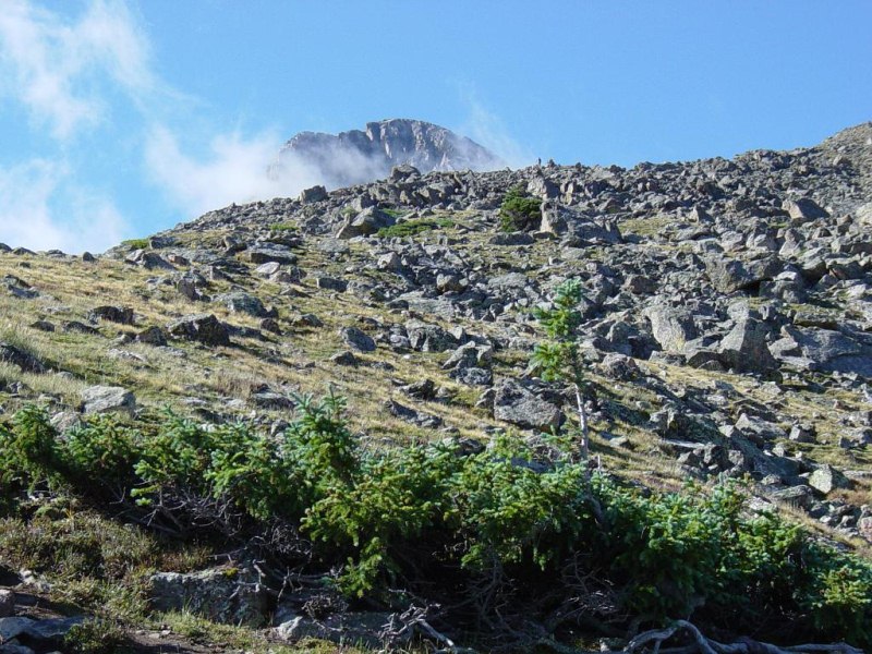
The Peak Sticking Up Above a Ridge
The Mountain of the Holy Cross, with an elevation of 14,005 ft, is the third lowest 14er in Colorado. Colorado has 53 peaks higher than 14,000 ft called 14ers. They range in height from 14,001 ft up to 14,433 ft. The Holy Cross Wilderness is one of the most beautiful areas of Colorado. The Mountain of the Holy Cross is known for a snow cross on ...
Full Post
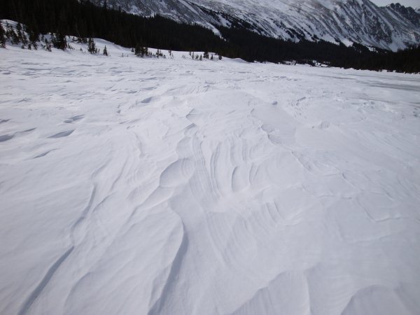
Crusty Snow on Long Lake
A few weeks ago a couple of us went for a snowshoeing hike close to Boulder. The Brainard Lake area is about 35-45 minutes from Boulder. During the winter the road to the lake is closed. The road is open during the summer and you have to pay to get into the area. You can either take the road or one of the trails north or south of the lake. On th...
Full Post
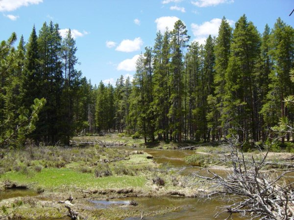
Valley Loop Trail Hike 6-03 - Colorado River 1
On the west side of Rocky Mountain National Park are the headwaters of the mighty Colorado River. To get there from the front range, we drove across the park on the Trail Ridge Road which goes above 12,000 ft. In June, you can see how much snow the park crews had to clear from the road. In some spots, there were snow walls 10 feet high on the si...
Full Post
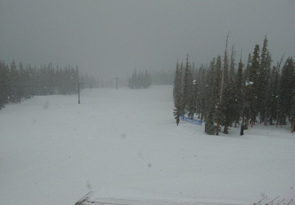
Keystone 4-03 - Looking Down From Top About Noon
Weather can change fast in the mountains. This day, I was snowboarding at Keystone. In the morning the skies were blue and the snow conditions were not good. The snow was hard packed. This first picture is of the North Peak from the top of the front mountain.
Looking down a trail at the base area.
...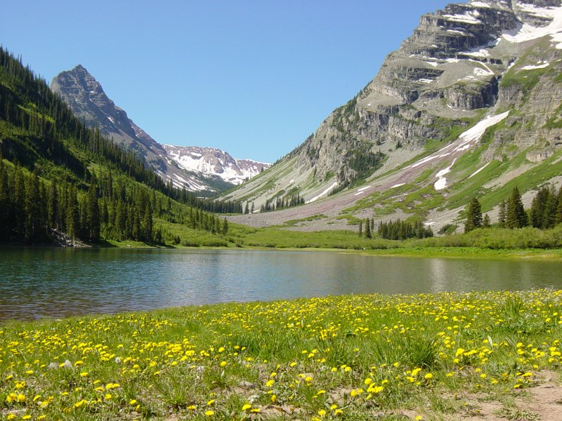
Maroon Bells 6-03 - Crater Lake with Flowers
These pics are from a hike near Aspen, CO, in a valley next to the Maroon Bells. This area is so popular that everyone has to take a shuttle bus in the area during summer days. If you go really early or in the evening the road is open to cars. We hiked up the valley along West Maroon Peak past two alpine lakes. It's a very scenic area. These pic...
Full Post
©2022 - 2026 Mountain Adventures LLC all rights reserved (Designed by On the Grid Web Design LLC)